|
Council
18 May 2016
|

|
Curio Bay
Wastewater Upgrade
Record No: R/16/4/6045
Author: Ian
Evans, Strategic Manager Water and Waste
Approved by: Steve Ruru,
Chief Executive
☒
Decision ☐ Recommendation ☐ Information
Purpose
1
The purpose of this item is to present a brief
business case/report to the Council seeking approval of the proposal to upgrade
the wastewater treatment plant and disposal system for the Curio Bay campground
and reserve, and recommend the overall project proceeds and that the contract
will be awarded at a subsequent meeting of the Activities Performance Audit
Committee.
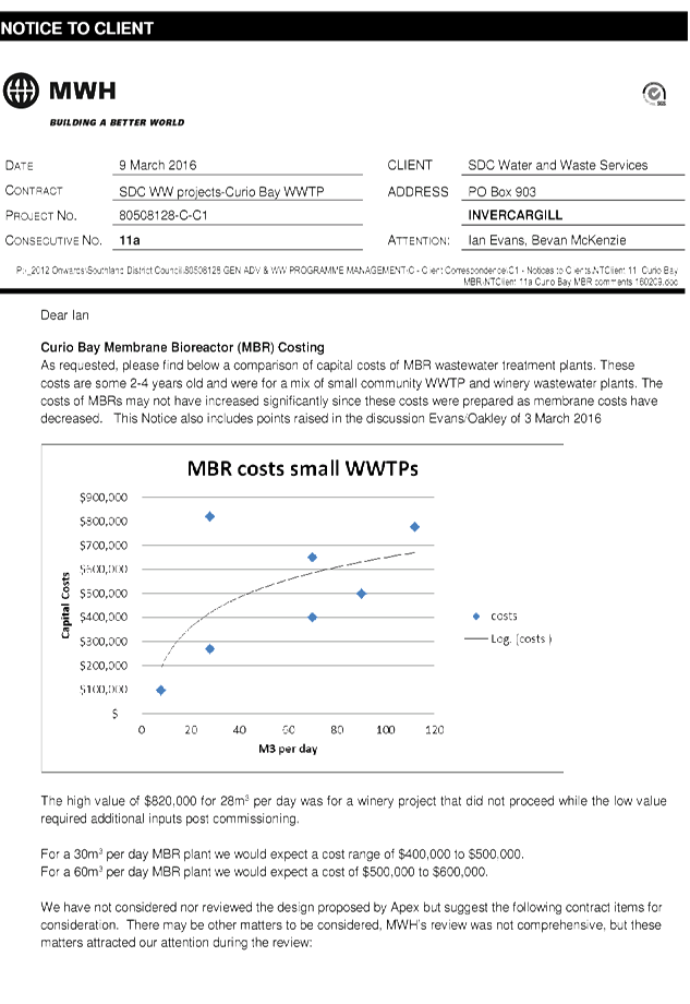
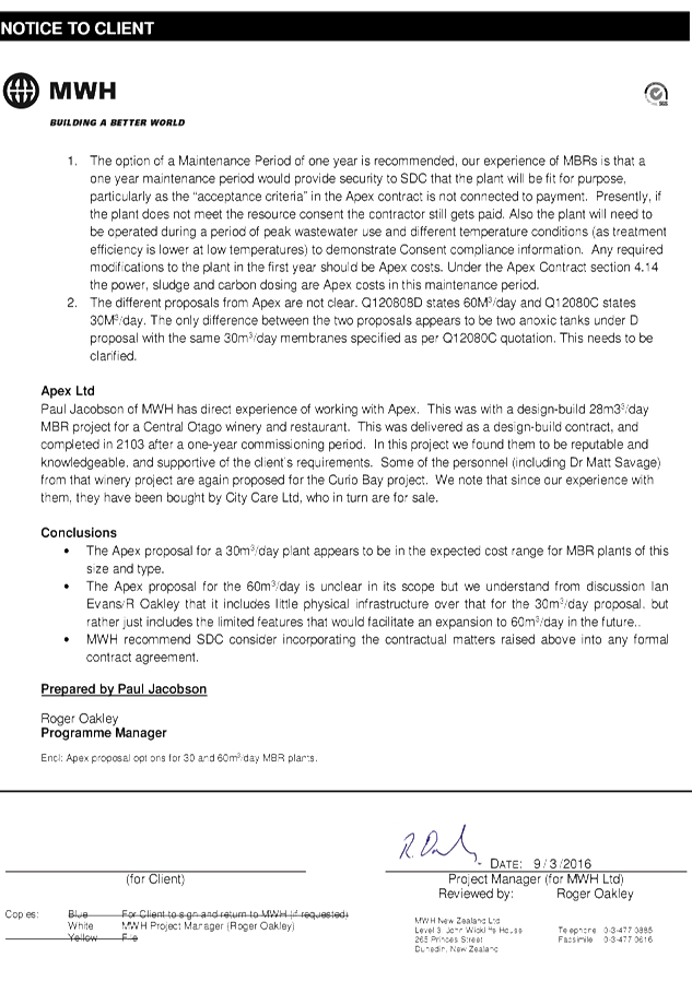
Executive
Summary
2
As part of the 2015-2025 Long Term Plan process,
Council budgeted funding for the upgrade of the wastewater treatment plant
serving the Curio Bay Recreation Reserve. Resource consent for the
discharge from the treatment plant was granted in November 2014, with the land
designated for that activity around the same time.
3
The upgrade forms an important part of wider
plans to improve facilities in the area and to help cater for growing numbers
of tourists. This wider work is being carried out in partnership with the
Department of Conservation (DoC) and the South Catlins Charitable Trust (the
Trust). Funding has been granted for a car park development and toilets
as well as the construction of a heritage centre building and upgrade to
campground facilities.
4 This
business case/report confirms the need for the development of the proposed
wastewater treatment system as the first stage of a wider reserve upgrade. It
also outlines how the project will be procured. Awarding of the contracts is to
be approved by the Activities Perfomance Audit Committee.
|
Recommendation
That the Council:
a) Receives
the report titled “Curio Bay Wastewater Upgrade” dated 5 May 2016.
b) Determines
that this matter or decision be recognised as not significant
in terms of Section 76 of the Local Government Act 2002.
c) Determines
that it has complied with the decision-making provisions of the Local
Government Act 2002 to the extent necessary in relation to this decision; and
in accordance with Section 79 of the Act determines that it does not require
further information, further assessment of options or further analysis of
costs and benefits or advantages and disadvantages prior to making a decision
on this matter.
d) Approves
the development of the wastewater treatment plant and associated works
at Curio Bay as part of the wider upgrade of the reserve at a total cost of
$875,364.
e) Agrees
that negotiations be finalised with the Department of Conservation and the
South Catlins Charitable Trust for contributions to the annual operating
costs of the Curio Bay wastewater treatment plant.
f) Agrees
to fund the annual operating costs of the wastewater treatment plant
upgrade and associated works at Curio Bay, after contributions from third
parties, by Councils General rate.
|
Content
Background
5 It
is confirmed that 100,000 people visit Curio Bay per annum and it is thought to
be more likely to be closer to 150,000. This last season in particular
has seen (anecdotally) increased traffic and numbers of visitors in the area,
many travelling the Southern Scenic Route. This presents challenges
particularly when the existing provision of infrastructure, facilities and
amenities does not meet current, let alone, future demand.
6 After
approximately 10 years of work to progress this project, Council was granted
consent for the proposed wastewater treatment plant, capable of being developed
to service the wider community, in November 2014. Along a similar
timescale the Trust was recently granted resource consent to build the Natural
Heritage Centre at Curio Bay. This facility will provide a
‘hub’ for the area and improve overall visitor management.
7 This
was a significant milestone for both projects and while the majority of
feedback/submissions were positive, the overall development still created strong
sentiment. This was because the proposed area is next to the yellow-eyed
penguin habitat, Curio Bay campground and 180 million year old petrified
forest. However, everyone agreed that the area was changing and people
would visit whether infrastructure was in place or not. Improved visitor
management and facilities were required.
8 This
project and the collaborative approach of Council, DoC and the Trust provides
an opportunity for the community to guide development and is underpinned by a
Memorandum of Understanding (MoU) signed by the three parties.
9 This
project is part of a larger vision for the area with development to the value
of approximately $5M planned for Curio Bay including:
· New
wastewater system (with funding confirmed through SDC’s Long Term Plan
process).
· New
car park and public toilets (DoC).
· Upgrade
campground (the Trust).
· New
Natural Heritage Centre (the Trust).
· Enhancing
recreational opportunities with walking tracks and interpretation.
10 A
significant contribution from the Community Trust of Southland has been
confirmed and an application had recently been submitted to the Lottery World
War One Environment and Heritage Fund. All going well, all aspects of the
$5M development will be underway by early 2016 accommodating the visitor season
and avoiding penguin nesting times.
11 The
overall development is an excellent example of Council, DoC and community
collaboration and partnership. The Document titled “A Vision for
Curio Bay” prepared by Venture Southland and updated in 2013 constitutes
the strategic business case for the overall development of facilities and
amenities at Curio Bay. The report, which is included as Attachment 1,
presents the current vision for the future of the campground and reserve.
12 In
order to facilitate the co-ordination and delivery of multiple projects being
completed by the three parties, an overall project co-ordinator has been
appointed. It is anticipated that this cost will be covered by all three
parties on a per use basis.
13 The current
brief business case for the upgrade of the wastewater treatment plant facility
aligns closely with the overall project planned by the three parties as
outlined in previous feasibility studies in support of the Trust’s
various applications for funding. These studies have been summarised and
Documented in ‘A Vision for Curio Bay 2013’.
Wastewater Treatment Plant
Upgrade
14 As
part of the 2015-2025 Long Term Plan process, Council budgeted funding for the
upgrade of the wastewater treatment plant serving the Curio Bay Recreation
Reserve. Resource consent for the discharge from the treatment plant
was granted in November 2014, with the land designated for that activity around
the same time.
15 A
number of previous options for treatment and disposal have been considered
including land disposal some distance up Mair Road but were discounted due to
high capital costs. Options around separation of grey and black water
were also looked at but presented less opportunity for a wider community scheme
and did not deliver the same overall environmental benefits that the consented
proposal allows.
16 In
summary, the proposal involves the construction of a package membrane
bioreactor treatment plant which would discharge through a rock contact bed to
a local drainage ditch. Further modifications to drainage within the area
would allow the ditch downstream of the discharge to revert back to more of a
wetland over time. The treatment plant is capable of producing a very
high quality discharge and is a very similar type of plant to that which DoC
installed to service its campground at Papatowai further into the
Catlins. There will also be construction of new pipework both within the
campsite and in the road to the new treatment plant.
17 The
treatment plant and pipework has been designed with future extension to the
Porpoise Bay subdivision and the wider community in mind. This will be
subject to further consultation with both the developer and wider community and
consideration of a number of funding issues.
18 The
development of the wastewater treatment plant is seen as pivotal to the work in
the area. If it does not go ahead it will severely restrict what other
work can proceed. As a consequence maintaining the status quo is not an
option.
19 It
is proposed to stage the upgrade as follows:
· Stage
1 - to service the reserve and campground (the current project does not extend
beyond this stage).
· Stage
2 - Porpoise Bay subdivision (subject to agreement with the developer).
· Stage
3 - community (subject to consultation).
Project Procurement
20 As
previously outlined it is proposed to split the work into two packages as it is
believed this will deliver the best outcomes for the project. Following
resolutions made at the APAC meeting on 28 October 2015 Water and Waste staff
continued to develop the proposed procurement package as follows:
Package One
21 It
is proposed to enter into a design build and operate contract for supply of a
package membrane bioreactor wastewater treatment plant. This is similar
to the model that DoC implemented for its campsite at Papatowai in the
Catlins. Subject to approval from APAC to award the contract a final
contract price of $477,600 capital and three years operational costs of $43,355
has been negotiated. Although the capital cost is slightly higher than
the indicative cost provided last year, it is largely due to some design
changes requested by Council staff and Opus to help ensure the plant manages to
remain compliant at times when large upturn and downturn in loadings would be
experienced. The current contract allows for a three year operating
contract once commissioned.
22 An
independent assessment of the contract price was also sought from MWH
(attached) which concludes that the proposal has been robustly costed and is
consistent with what a plant of this design might cost and that we would be
unlikely to get a more favourable outcome by going through an open tender
process.
Package Two
23 Drainage
modifications, pipelines and connections to new developments on the reserve,
those being the approved Heritage Centre and a new campsite ablution block as
well as connecting the existing toilets was tendered as a package. The
tender was advertised in January 2016 with two compliant tenders
received. Following clarifications and based on tenders received it is
proposed to award this package for a tendered price of $137,764 (subject to
APAC approval).
24 Further
earthworks, access and fencing costs have been omitted from these two contracts
and will be undertaken by local contractors as required. An allowance has
been made in the overall budget for this work and is based on an Opus
assessment of previous similar work.
Benefits of Proposed Approach
25 There
are a number of benefits to using this type of approach for the delivery of
package one.
26 The
Early Contractor Involvement (ECI) type of approach is becoming more common
within the construction industry and helps to optimise price, control, risk
management and allocation for the Principal. Council successfully used
this model to deliver upgrades to four water treatment plants in 2014 on
time and within budget.
27 This
is a highly technical plant with limited suppliers capable of delivering a
design build operate contract of this nature. This model is particularly
suited to deliver this package.
28 The
key difference between traditional tendered contracts and ECI is the
involvement of the contractor at a much earlier stage and in the process having
complete buy-in at the detailed design stage. The rationale behind this is
that during this early stage of project planning, the greatest influence on
capital costs and project outcomes is possible. It is essentially a form
of collaborative contracting and like Alliance Contracts envisages the early
involvement of the contractor and the adoption of ‘best for
project’ attitudes by all parties.
29 Through
an open book (negotiated/guaranteed maximum price) arrangement, Council will
have full visibility of all costs, overheads and margins, therefore ensuring
that the budget available is used to maximum effect.
Factors to Consider
Legal
and Statutory Requirements
30 The
Local Government Act contains sections that have to be considered in proposing
a method for managing a project such as the current proposal.
Section 10 sets out general requirements:
10 Purpose
of local government
(1) The purpose of local government is—
(a ) to enable democratic local decision-making
and action by, and on behalf of, communities; and
(b) to meet the current and future needs of
communities for good-quality local infrastructure, local public services, and
performance of regulatory functions in a way that is most cost-effective for
households and businesses.
(2) In this Act, good-quality, in relation
to local infrastructure, local public services, and performance of regulatory
functions, means infrastructure, services, and performance that are—
(a ) efficient; and
(b ) effective; and
(c) appropriate to present and anticipated
future circumstances.
31 For
a decision that is inconsistent with an adopted policy, Council is required
under Section 80 of the Act to record the fact that the decision is
inconsistent, the reason as to why Council is making the decision and whether
it intends reviewing its policy as a result of making the decision.
Community
Views
32 There
has been a significant amount of community consultation on all elements of the
proposed wider development over the past decade. Recent Long Term Plan
consultation and submissions to the applications for both the wastewater
treatment upgrade and the Heritage Centre have been largely very positive and
supportive of the proposal. In addition, a number of public meetings and
presentations have been well attended and again largely supportive.
Although any move to connect in the wider community would require further
formal consultation, informal feedback has also been positive.
Costs
and Funding
33 Through
the 2015-2025 Long Term Plan, Council included the funding of the wastewater
treatment upgrade which was considered essential for other proposed
developments to proceed. In essence this is the first step of a wider
vision of services provided within Curio Bay. Current indications from
both DoC and the Trust are that both parties are committed to their various
projects and agree that the provision of the wastewater treatment plant is the
first critical project that is required.
34 The
budget for the upgrade sits within the Parks and Reserves activity of Council
as this is essentially an upgrade to facilities at the reserve. The
facility will transfer across to a community wastewater scheme if and when
agreement is reached to connect in the Porpoise Bay subdivision and the wider
community. A policy is currently being developed to ensure that future
costs associated with any community connection is equitable to all required to
be connected. Once connected all properties will then be subject to the
district-funded wastewater rate, with the reserve activity reverting to a per
pan basis.
35 The updated
estimated cost as per the table in paragraph 39 is $875K, which is lower than
previously expected and largely due to the favourable contract price received
for the reticulation works, and is less than the estimated budget of $970K as
per the
2015-2025 Long Term Plan.
36 No specific
allowance was made in the Long Term Plan for any maintenance and electricity
costs, however these have now been included as part of the Draft Annual Plan
for 2016/2017. Preliminary discussions have taken place with DoC and the
Trust for contributions to these costs for future years. Any contribution
is contingent on it remaining as an upgrade serving the reserve rather than the
wider community. If the scheme is opened to the wider community then the
contribution will be via the District rate to the reserve on a per pan
basis.
37 The total cost of the project is estimated below
Summary of Capital Costs
|
Capital Cost
|
Value
|
|
Contract 16/2 (Membrane Plant)
|
$477,600
|
|
Contract 16/3 (Drainage, pipelines etc)
|
$137,764
|
|
Earthworks / access/ landscaping
|
$45,000
|
|
PowerNet
|
$35,000
|
|
Opus Project Management
|
$60,000
|
|
SDC staff time
|
$40,000
|
|
Contingency @ 10%
|
$80,000
|
|
|
$875,364
|
38 Funding for this project will be based on the funding
sources identified in the 2015-25 Long Term Plan. This will result in
$115K coming from the District Operations Reserve, $100K from the Financial
& Reserve Contribution fund (already allocated) and the balance $660K to be
funded by a 25 year internal loan.
Estimated Operational Costs
39 Some annual costs were included in the 2015-2025 Long Term
Plan. These costs include estimated depreciation (including funding of
deprecation in line with the policy adopted in the Long Term Plan) and interest
and principal loan repayments.
40 Operational costs that were not included in the Long Term
Plan are the costs of maintenance/running of the plant ($45K per annum),
electricity ($5K - $8K per annum) and maintenance on the pipe reticulation of
$5K per annum. The first two costs will be incurred as soon as the plant
is commissioned (2016/2017) and the maintenance on pipe reticulation is likely
to be needed after three years (2019/2020).
41 Operational costs for the maintenance/running of the plant
have been updated as part of the draft Annual Plan for 2016/2017. The
draft Annual Plan includes $45K for operations/maintenance of the plant and $5K
for electricity. These costs are the expected costs for a full financial
year. As the plant will be commissioned part way through the year the
costs incurred during 2016/2017 will be lower.
42 Loan repayments have been removed from the draft Annual
Plan for 2016/2017 as no loan repayments will be required during the 2016/2017
financial year. Internal loans are drawn down at the end of the financial
year that the capital work is completed, with repayments required in the
following financial year. The capital work expected to be completed in
2015/2016 will be funded from contributions and reserves, with no loan required
until the majority of the capital work is completed during 2016/2017.
43 As the capital asset is not complete at 30 June 2016 and
cannot be depreciated under accounting standards, funded depreciation has also
been removed from the draft Annual Plan. An asset is not depreciated
until it has been completed and available for use, this will be part way
through the year. If the asset had been completed during 2015/2016 the
depreciation to be funded would have been $7,254. It is anticipated that
the any depreciation to be funded in line with the current policy will be able
to be funded from the expected underspend in operational costs for the year.
44 Council staff would look
to recover some of the operational costs from the Trust and DOC.
Discussions have yet to be held with the Trust and DOC. Council staff would
look to recover $15K per annum with the balance being funded from the General
rate. No income from the Trust and DOC has been included in the draft
Annual Plan.
45 The
estimated costs for 2019/20 relating to interest and principal are based on the
capital cost detailed above of $875K.
|
Annual Costs
|
Long Term Plan
2016/2017
|
Draft Annual Plan
2016/2017
|
Estimate for
2019/2020
|
|
Included in relevant plan
|
|
|
|
|
Interest
|
$46,887
|
-
|
$38,662
|
|
Principal
|
$13,008
|
-
|
$13,697
|
|
Funded Depreciation
|
$7,254
|
-
|
$15,026
|
|
Operation/Maintenance Contract
|
-
|
$45,000
|
$43,335
|
|
Electricity
|
-
|
$5,000
|
$8,000
|
|
Reticulation Maintenance*
|
-
|
-
|
$5,000
|
|
|
|
|
|
|
Total in Rates
|
$67,149
|
$50,000
|
$123,720
|
|
|
|
|
|
|
Excluded from the
Long Term Plan (additional rates)
|
|
|
|
|
Operation/Maintenance Contract
|
$43,335
|
-
|
-
|
|
Electricity
|
$8,000
|
-
|
-
|
|
|
|
|
|
|
Total costs not in Long Term Plan
|
$51,335
|
-
|
-
|
|
Total Annual Costs
|
$118,484
|
$50,000
|
$123,720
|
|
Less potential cost recovery
|
($15,000)
|
-
|
($15,000)
|
|
Total Estimated Rate
Cost
(before inflation)
|
$103,484
|
$50,000
|
$108,720
|
* The reticulation is the pipework owned by the Council.
It is expected that all other parties connecting to the wastewater system will
pay the cost for their own connection and any
ongoing maintenance.
46 The amount of
depreciation to be funded will adjust each year until it is fully funded in
2024/2025. This is in line with the policy adopted during the 2015-2025
Long Term Plan. This policy allows for an additional 10% depreciation to
be funded each year until 2025 when 100% of depreciation is funded. The
estimate for 2019/20 allows for depreciation funding after principal repayments
of 50%.
Cost Sharing
47 Previous
discussions around funding the operational costs of the scheme suggested a cost
sharing approach between the Council, the Trust and DoC being the three parties
connected to the plant. This approach would be revised at some point in
the future if the scheme were to be extended to the Porpoise Bay subdivision
and to the wider community, in which case it would fall under the district
sewerage rating.
48 The discussions
were based on the principle that each of the parties should contribute to the
operating cost of the sewerage scheme and contribute to the cost of capital for
the scheme. The Trust and DoC both had the same response in terms of the
principle of contributing to capital costs, that being that they did not see
the added burden of capital costs as being part of their business case.
Generally it was considered that the Southland District Council’s capital
contribution is the Council’s share as a partner in a three way joint
project to deliver higher class facilities for the large and growing number of
visitors coming to the site.
49 The Trust and
DoC accepted the principle that contributions should be made to the operating
cost of the scheme but agreement on the quantum of that contribution has not
yet been reached. DoC in particular explained their policy was that the
level of contribution should be close to the equivalent cost of them having to
maintain and operate a set of standalone toilets. The basis for this
logic is that is what they would be up for if the SDC did not construct a
sewerage scheme.
50 Similar logic
exists for the Trust as they would have to operate a separate scheme if the SDC
plant was not constructed. This is where working together for the benefit
of the community is best demonstrated. Each organisation is contributing
in the order of $1 million dollars to make this collective project viable.
51 Discussion with
these two organisations needs to continue so as to achieve agreement about the
level of contribution towards operating costs in time for the 2017/18 budget
when the scheme will be in full operation. Until then the operating costs
will be a prorated amount of the annual estimated operating cost dependant on
when start-up of the plant occurs and the scheme is handed over from the
contractor.
Risk Analysis
52 A high level
analysis of the key risks associated with undertaking the project has been
undertaken and are presented in the following table. A risk
register will be developed as the project progresses with key risks re-assessed
at significant milestones or if there are significant changes to scope.
|
Risk
|
Probability
|
Consequence
|
Mitigation
|
|
DOC/Trust do not
proceed with proposed upgrades
|
Low
|
High
|
This is unlikely as
both parties have secured the majority of the funding for their respective
upgrades.
|
|
Parties
cannot commit to ongoing contribution to annual opex costs
|
Moderate
|
Low
|
Ongoing dialogue
between parties and through the Governance Group.
|
|
Costs of installing a
wider community scheme are not equitably spread
|
Low
|
High
|
Early development of
funding policy to ensure costs to all parties required to connect are fair
and equitable.
|
|
Failure to deliver
project to budget
|
Low
|
Moderate
|
Use of Quantity
Surveyor to ensure contract delivers value/ robust tender processes
|
|
Porpoise
Bay Ltd opt to install their own wastewater treatment system
|
Low
|
Moderate
|
Ongoing dialogue with
Porpoise Bay Ltd and ensuring they are aware of the implications of the final
funding policy. Minimal risk to design if this occurs as will require
limited design alterations. Opex costs would not be able to be spread.
|
|
Community choose not to
connect in following consultation
|
Moderate
|
Low
|
Current design is to
service Reserve and potentially Porpoise Bay at this stage. Further
consultation with the community will be undertaken to ensure complete
transparency.
|
|
Failure of existing onsite
wastewater systems within the community
|
Moderate
|
High
|
Consultation on joining
sewerage scheme as an alternative to potentially expensive upgrade of onsite
systems.
|
|
Impact of Environment
Southland Water and Land Plan
|
High
|
Moderate
|
Council will submit
once plan is notified for submissions.
|
|
Increasing visitor
numbers increase pressure on inadequate infrastructure
|
High
|
High
|
Proceed with proposal
for wastewater treatment upgrade for the reserve.
|
|
Risk of visitors to
campground dropping off as a result of inadequate facilities (or through
negative reviews on travel websites)
|
Moderate
|
Moderate
|
All parties proceed
with upgrade proposals to improve visitor experience.
|
Policy
Implications
53 Council
is committed to ensuring it obtains value for money in procuring goods and
services. Section 7.2 of Council’s Procurement Policy requires that
procurement policies over $20K will generally be made on the basis of a
competitive tender. Obviously, the current proposal is not in line with
this part of the policy.
54 However,
Section 7.3 of the policy does allow for Council to consider opportunities to
procure goods and services through alternative arrangements such as
negotiations with a single supplier where it can be demonstrated that this
could provide a better outcome.
55 In
essence, the policy does make allowance for such an approach provided it can be
demonstrated that this will deliver the best outcome.
56 The
challenge is to demonstrate how this procurement approach will deliver the best
value for money outcome for the Council. A key to demonstrating value for
money is to be able to demonstrate what a competitive price for the work is,
hence the reason for the independent review of the proposal to negotiate with
one party. In a simple open tendering process this is demonstrated by
competing tenders. It is not possible to have competing tenders when a
sole supplier situation exists as it does with this project.
57 The
way to demonstrate value for money is to have independent market experts
calculate the likely competitive market price for the work. These
experts, known as quantity surveyors provided a similar audit on costings and
risk on a previous directly negotiated contract.
Analysis
Options Considered
58 Based on
previous approvals and competitive prices received for both tenders, the only
options now to consider are either to approve or not approve the business case
for the overall project to approve. Decisions around awarding contracts
will be made at a subsequent APAC meeting.
Analysis of Options
Option 1 – Give
approval for the project to proceed
|
Advantages
|
Disadvantages
|
|
· Allows
both the wastewater scheme as well as the wider development to proceed.
By proceeding at this stage it is likely that the plant will be substantially
complete by next holiday season.
· Consistent
with delivering what is allowed for in the 2015/2025 Long Term Plan.
· Opportunities
for future expansion and development.
|
· None.
|
Option 2 - Do not give approval for the project to proceed.
|
Advantages
|
Disadvantages
|
|
· None
|
· Significant
potential to negatively impact on the wider development and consequent risk
of external funding losses from external agencies.
|
Assessment
of Significance
59 In
this report the Council is being asked to give approval to proceeding with the
construction of the proposed wastewater scheme at Curio Bay campground and reserve
and the subsequent arrangements for procuring the project.
60 The
project is provided for in the 2015 Long Term Plan and has been the subject of
ongoing discussion with the different agencies involved for some time. Officers
are of the view that it is reasonable to conclude that the decision is not
significant in accordance with the Significance and Engagement Policy.
Recommended
Option
61 It
is recommended that Council approve the business case for the wastewater
treatment plant upgrade. Recommendations on contract award will be made
at the APAC meeting.
Next
Steps
62 Council
staff present a report to APAC recommending that contracts are awarded for the
upgrade of the wastewater treatment plant, and hence enter into the detailed
design phase of the project.
Attachments
a FINAL
- A Vision for Curio Bay 2013 Update View
b Notice
To Client 11a Curio Bay MBR comments 160209 View
|
Executive
Summary
|
3
|
|
Section
1: About the Area
1.1 The
Catlins
1.2 Curio
Bay/Tumu Toka
|
5
|
|
Section
2: Issues
and Challenges for Curio Bay
2.1 Visitor flows
and numbers
2.2 Improvements
in roading and telecommunications
2.3 Significance
and sensitivity of area
2.4 Challenges of
location and area
2.5 Inadequate infrastructure
2.6 Collaborative
approach
2.7 Realising the
economic benefit
|
8
|
|
Section 3:
Collaboration and a Shared Vision
3.1 Three key
stakeholders
3.2 Memorandum of
Understanding signed in 2012
3.3 Governance
group established
3.4 The Shared Vision
3.5 Achieving the
Vision
|
11
|
|
Section 4:
Curio Bay Living Forest and Walkway
4.1
Significance of Smiths Bush
4.2
Benefits of purchasing Smiths Bush
4.3 The
Trust’s Approach
4.4 The
Curio Bay Living Forest and Walkway Project
4.5 Cost
of the Project
4.6
Funding of the Project
4.7 Progress to Date
|
15
|
|
Section 5:
Waste Water Infrastructure
5.1 Other
Options Investigated
5.2 A
Solution is Identified
5.3
Funding the Solution
5.4
Progress Continues
|
20
|
|
Section
6: Curio Bay Recreation Reserve
6.1 Cost
of the Project
6.2
Funding for implementation
6.3
Collaborative Approach means sharing of infrastructure and associated costs
6.4 Waste
water infrastructure
|
23
|
|
Section
7: The Natural Heritage Centre
7.1 Background
7.2
Description
7.3
Economic Benefits
7.4
Progress
7.5 Cost
of the Project
|
26
|
|
Section
8: Curio Bay Camp Ground
8.1 The Current Situation
8.2 The
Proposed Upgrade
8.3 Cost of
the Upgrade
8.4
Cultural and Community Considerations
8.5 Waste
Water Infrastructure
8.6
Progress Forward
|
31
|
|
Section 9:
Porpoise Bay Beach
9.1 Beach Access
9.2 Sand Dunes
9.3
Interpretation Opportunities
9.4 Beach Safety
|
35
|
|
Section
10: Infrastructure
Site Development
10.1 Reasoning behind the “Central Arrival
Area”
10.2 Access into the Area
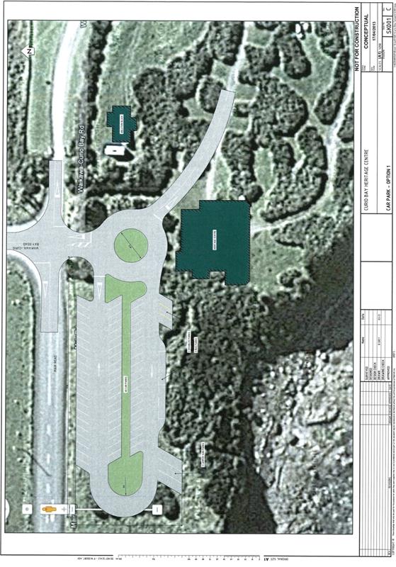
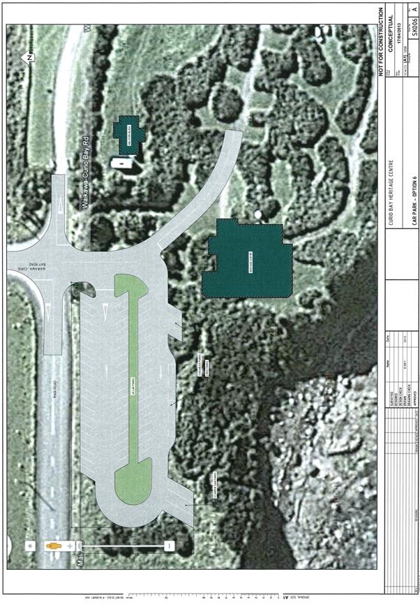
10.3 The Car Park
10.4 Toilets
10.5 Enhancement of the current water supply
10.6 Interpretation and Tracking
|
39
|
|
Summary
|
44
|
|
Appendices
Appendix A: Information about the Trust
Appendix B: Memorandum of Understanding
Appendix C: The Vision for Curio Bay
Appendix D: Mike Pole Supporting Information
Appendix E: Building Plan for Ablution Block
Appendix F: Building Plan for Natural
Heritage Centre
Appendix G: Waikawa Harbour Mataitai Reserve
Appendix H: Possible Plans for the Car Park
|
45
|
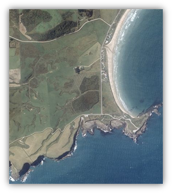
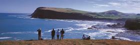
Curio Bay and Porpoise Bay are unique localities of
international significance primarily because of the 170 million year old
Petrified Forest platform. Visitors (confirmed at 100,000 but thought to
be more likely 150,000) continue to visit the area in increasing numbers,
travelling along the internationally acclaimed Southern Scenic Route into The
Catlins.
The area is very important to local iwi and the local
community for its recreational, cultural and historical value. It is
truly difficult to find a comparable site elsewhere which has such a sensitive
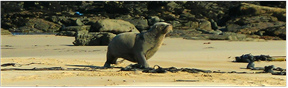
and unique natural environment - Curio Bay is home to rare and endangered
yellow eyed penguins and New Zealand sea lions as well as Hectors
Dolphins. It is also thought to be the only site in the world
where a living replica of a petrified forest can be found adjacent to its 170
million year old predecessor.
The community are currently developing the Curio Bay Walkway
and Interpretation through this living replica of forest. It is classified as a
“Gateway” destination by the Department of Conservation (DOC).
The Issues
· An extremely
sensitive, natural environment of international significance…
· Significant
growing numbers of visitors…
· Out-dated and
inadequate infrastructure to meet demand and address needs.
Implications
Out-dated and inadequate infrastructure includes lack of
toilets and parking and a failing septic tank system which currently services
the camp ground and recreation reserve. Incredibly there are no toilets
for the 100,000 visitors to the Petrified Forest platform and a car park which
parks about 15 vehicles. This is impacting the community, environment and
visitor experience with:
· Failures in the
septic tank creating health issues for locals and visitors as well as the obvious
impacts upon the environment and wildlife.
· Lack of parking
for all types of vehicles creating unsafe vehicle movements and parking on the
side of the road.
· Overall
opportunities from tourism not being realised by local businesses and the community.
The Solution
There is a commitment from key stakeholders to look after
the area as reflected with a recently signed Memorandum of Understanding
(Appendix B). This commitment is illustrated on the map in Appendix C
which shows the number of initiatives and projects planned for the area which
all contribute to a shared collaborative vision.
Each stakeholder is able to contribute financially towards
various projects totalling approximately $4.8 million. To date, over half
of the required funding has been sourced, reflecting the support and “buy
in” from community funders and stakeholders.
It is widely agreed that this unique example of a
collaborative approach is the only possible way of successfully looking after
this very special area.
The Priority
The priority is to address the area’s waste water
needs first and foremost. This is essential and underpins all projects
including an upgrade of the camp ground and recreation reserve. An
affordable waste water solution has been identified and is estimated to cost
about $550,000. To date funding of $300,000 has been secured, leaving a
deficit of $250,000.
Section 1: About the Area
1.1  The Catlins
 When Europeans arrived in the area, they found it easier to
cut-off this south east corner of the South Island (for favourable inland
routes) and it almost become a forgotten region. Described as remote and
more ‘West Coast’ than the West Coast itself, it was rarely
visited.
When Europeans arrived in the area, they found it easier to
cut-off this south east corner of the South Island (for favourable inland
routes) and it almost become a forgotten region. Described as remote and
more ‘West Coast’ than the West Coast itself, it was rarely
visited.
 Sealing
and whaling were the first industries, followed by the milling of native timber
and subsistence farms. The area is exposed to the southern storms that
roar up from the Antarctic and it was generally a difficult place to live
– horizontal trees near the coast are a common sight.
Sealing
and whaling were the first industries, followed by the milling of native timber
and subsistence farms. The area is exposed to the southern storms that
roar up from the Antarctic and it was generally a difficult place to live
– horizontal trees near the coast are a common sight.
Today,
the secret is out and the Catlins is developing into an increasingly popular
emerging tourist destination. Roading has improved access and the
internationally renowned ‘Southern Scenic Route’ traverses through
the region which spans both the Clutha District and Southland District Council
territories (referred to as North and South Catlins areas respectively).
Low
profile eco tourism is establishing itself in the area with the emergence of a range
of accommodation including B & Bs, homestays, backpackers and motels as
well as a number small tourist and wildlife businesses. For further
information please see www.catlins.org.nz
Today,
pastoral farming continues to be the predominant industry with most of the
population either engaged or in related service industries.
The
number of permanent residents is relatively low compared to the
summer
months when increasingly growing numbers of domestic and
international visitors descend into the area.
1.2 Curio
Bay / Tumu Toka
·  Curio Bay is located on the South Catlins coast in the Southland
District.
Curio Bay is located on the South Catlins coast in the Southland
District.
· Porpoise Bay is often
considered alongside Curio Bay because of its close proximity.
· There are a small number
of permanent resident homes but the population dramatically increases in the
summer.
·  There are residential
subdivisions currently planned that will add approximately 22 sections, plus
accommodation and a restaurant.
There are residential
subdivisions currently planned that will add approximately 22 sections, plus
accommodation and a restaurant.
· The area has a long
history of Maori occupation and, as with the rest of the Catlins, was an
important food source area for Maori. The area was later settled by European
whalers and sealers in the 1850s and 1860s.
· In recent years, Curio
Bay has become a popular holiday and day trip destination, particularly for
New Zealanders. The camping ground is located on the headland and has been
used by locals and families for many years for an authentic, kiwi camping
experience.
· Curio Bay has developed
as one of the key visitor destinations in Southland. Further to this, the area
is a destination on the now popular Southern Scenic Route. Increased visitor
numbers are putting pressure both on infrastructure and the environment
(University of Otago, 2004).
· Currently 150,000 people
are visiting the area with the Petrified Forest attracting 86% of all visitors
(DOC, 2007) and confirmed numbers of 100,000.
· Tourist visitation to
the area is already at a level that cannot be sustained with the current
management and infrastructure.
· However, a number of new
businesses have developed as a result of increases in tourism and the efforts
of the South Catlins Development and Environmental Charitable Trust (The
Trust).

The Curio Bay area is home to
geological and environmental attractions of international significance such as:
|
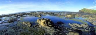
An INTERNATIONAL TREASURE, a 170 million year old Fossil
Forest recognised as one of the best examples of Jurassic Fossil Forest
in the world. The platform of petrified stumps, fallen trees and fern
imprints are easily accessible by foot at low tide, or can be viewed from the
platform above.
|
|
|
Smith’s Bush Block - is one of the few examples of Coastal Lowland
Forest, such is significant as an example of a successor of the Petrified
Forest. It is especially rare because of its proximity to the petrified
forest.
|
|
|
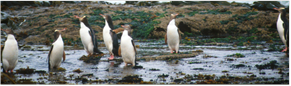
A nesting site for NZ’s unique and rare yellow-eyed
penguins/hoiho.
|
|
|
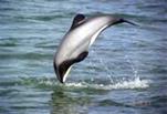
Regular visitation by rare and endangered Hectors
Dolphins, one of the smallest and rarest marine dolphins in the world.
|

|
|
Diverse coastal landscape of Curio and Porpoise Bays.
|
|
|
Resting site to other marine mammals including
New ZEALAND fur seals, sea lions and is home to blue penguins.
|
|
|
Curio Bay Camping Ground (situated on the Curio Bay Recreation Reserve) which
has camp sites nestled subtly into flaxes, overlooking Porpoise Bay and the
Petrified Forest.
|
|
 Section 2: Issues
and Challenges
Section 2: Issues
and Challenges
2.1 Visitor
flows and numbers
Visitors continue to visit the area with numbers estimated
ten years ago eventuating. At present DOC confirms (with accurate foot
counting) that there are 100,000 visitors to the Petrified Forest platform but
this number will not necessarily include locals, day visitors to the beach and
some campers. It is estimated that the actual number of visitors is more
likely 150,000.
Vehicle road counts also support significant numbers of
traffic in the peak visitor season which runs from October to April.
Curio Bay is situated on the Southern Scenic Route in The
Catlins, an emerging tourist destination of international significance.
Even without actively encouraging people to visit, visitors will still
come. It does not appear to be a choice to ‘not do anything’
because it will be at the detriment of the community and environment. Rather
the approach is to proactively plan and manage the development of tourism in
the area which will ensure the environment is protected and the local community
benefits where possible.
The challenge is to manage visitors and vehicles in small,
sensitive environment which currently lacks adequate infrastructure.
2.2 Improvements
in roading and telecommunications
In the past ten years there has been significant upgrades of
the roading network and telecommunications which has not only improved
people’s ability to communicate, but also to access and travel through
the area.
The sealing of the main road into and through the area has
meant that all types of rental vehicles can easily access this area which is
somewhat remote. There are still a number of unsealed roads in the area
but there are ongoing efforts to keep improving these to ensure optimum safety
for locals and visitors.
The Rural Broadband Initiative (providing broadband internet
to schools) and the Vodafone Cell Site Scheme (aiming to provide cellular
coverage to remote areas which currently have none) will have a significant
impact on both local’s and visitor’s ability to communicate, run
businesses, book travel en route etc. With upgrades due to be completed
in 2013, it is unsure what the full impact of this will mean for the
area. It is however thought that it will make the area more accessible
and attractive to both visitors and local businesses trying to operate.
2.3 Significance
and sensitivity of area
The area is very important to local iwi and the local
community for its recreational, cultural and historical value. It is
truly difficult to find a comparable site elsewhere which has such a sensitive
and unique natural environment - Curio Bay is home to rare and endangered
yellow eyed penguins and New Zealand sea lions as well as Hectors
Dolphins. It is also thought to be the only site in the world
where a living replica of a petrified forest can be found adjacent to its 170
million year old predecessor. The community are currently developing the
Curio Bay Walkway and interpretation through this living replica of forest.
Ideally, the best way to protect and preserve such a
sensitive site is to limit access and ensure that the priority is to preserve
the habitat and local environment. However, the community and DOC believe that
there is a unique opportunity to share with the public, the unique experience
which Curio Bay can offer. Education can provide preservation. This
can only be achieved with the collaborative approach as outlined in this
document (Section 3).
2.4 Challenges
of location and area
Curio Bay is situated in The Catlins at the southern end of
the syncline. It has been seen as ‘remote’ for a number of
reasons including its geographic separation from the rest of Southland, lack of
cell phone coverage and ability to communicate and gravel road network.
Recent improvements in sealing roads and telecommunications are assisting.
The total number of households in Curio Bay is about 28
which presents challenges to fund local infrastructure with rates. The
availability of central government subsidies appears to not be as reliable as
it has in the past.
2.5 Inadequate
infrastructure
Inadequate and out dated infrastructure presents a number of
health and safety concerns.
The Petrified Forest platform area does not have any public
toilets and the only option for the 100,000 visitors, is to use the toilets in
the adjacent camping ground (situated on a recreation reserve and adjacent to
yellow eyed penguin nesting habitat). Built at least 40 years ago, these
toilets are very basic and struggle to meet the needs and expectations of
users. As well as servicing these visitors, they also service campers and
day visitors to the popular beach at Porpoise Bay.
No one disputes that the quantity and quality of toilets
need addressed at Curio Bay and the urgency of this.
Directly linked to the provision of toilets are the failures
the current septic tank system is experiencing. These are extremely
concerning and have not only compromised the health of local residents and
visitors but also threaten the very sensitive local environment.
The final concern is related to the area’s inability
to manage the quantity of vehicles in peak season. The Petrified Forest
currently has a 15 vehicle car park which unsurprisingly struggles to cope with
100,000 confirmed visitors to the Petrified Forest. This has meant that
cars, campervans and buses have just had to park where they can, creating an
unsafe environment.
Overall there is a need to not only provide more
infrastructure but also better manage people and vehicles to the area.
2.6 Collaborative
approach
Because of the unique situation of Curio Bay and challenges
faced, it has been difficult in recent times to identify and work together on a
collaborative approach and vision forward. Individual stakeholders have
been undertaking projects e.g. redevelopment of the Petrified Forest viewing
platform and interpretation, but there has not been an overall shared
approach.
It has taken a significant level of cooperation and
compromise to reach the milestone of the signing of the Memorandum of
Understanding in 2012. This collaborative approach recognises that each
party is actually working towards similar goals and there are opportunities to
achieve these for mutual benefit with a shared approach and plan.
2.7 Realising
the economic benefit
A key goal is for local
businesses to capitalise on the numbers of visitors to the area by creating
employment and new enterprise development while ensuring the sustainable
management of the area.
This can be achieved by
developing more tourist product, encouraging visitors to stay longer and
improved visitor management at Curio Bay.
The local community and
operators appear to understand the value of tourism and benefits and have had a
significant role in developing plans and working with local government to
control its development and growth as much as possible.
Section 3: Collaboration and a Shared Vision
3.1 Three
key stakeholders
Alongside a passionate local community, there are three key
stakeholders who are fully committed to looking after the area:
· Southland District
Council (SDC)
· South Catlins
Development and Environmental Charitable Trust (The Trust) – See Appendix
A.
· Department of
Conservation (DOC)
Each stakeholder has a role as an owner or manager of land
in the area. For example, DOC look after the scientific reserve which the
Petrified Forest is situated on and the Trust lease the SDC Recreation Reserve
which the camping ground is situated on as well as own ‘Smiths
Bush’ which is where the Curio Bay Walkway is currently being developed.
There are also 28 residential households and a number of
commercial accommodation providers situated at Curio Bay.


3.2 Memorandum
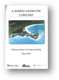
of Understanding signed in 2012
In 2012, the three key stakeholders signed a Memorandum of
Understanding (MOU) which outlined a shared vision forward, in terms of
providing the necessary infrastructure, services and facilities to meet the
needs of the visitors, locals and the environment (Appendix B).
The MOU was signed by Her Worship Frana Cardno (Mayor of the
SDC), Barry Hanson (Conservator DOC) and Pam Callahan (Chair of the Trust).
What is apparent and reflected in the MOU is that each party
has similar goals in respect to the area and by working collaboratively, there
are benefits including the ability to ‘share infrastructure’ and
associated development and ongoing costs.
What is also acknowledged is that this collaborative
approach is the only possible way of successfully looking after this very
special area. Despite each individual’s best efforts and intent,
there has been limited progress and success to date.
The MOU outlines a number of individual projects and
initiatives which have been and will continue to be undertaken by individual
stakeholders. What it does though is show how they all contribute towards the
overall shared vision and overlap with each other, providing benefits of
sharing infrastructure and ensuring the most efficient use of land etc.
3.3 Governance
group established
Following the signing of the MOU, a governance structure was
established. It was the role of this group to provide an overall strategic view
of the area guided by the MOU. The three stakeholders were represented
and meetings are held as required. It is also important that local iwi are
involved and an invitation has been extended for them to be a part of the
governance structure.
The top level of the governance structure has a
representative from each stakeholder plus iwi. Reporting to this group is
the project management team which consists of the people physically undertaking
various projects.
This structure provides ongoing communication and
collaboration and ensures seamless integration of operational issues with
governance. This is essential but it is acknowledged that once
implementation of the various projects has occurred, a different structure may
be appropriate to monitor the area.


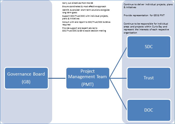
Figure 2: Proposed Governance
Structure for Curio Bay
3.4 The
Shared Vision
The map in Appendix C shows the shared vision as outlined in
the MOU. This vision consists of developing a “Central Arrival
Area” which is where the majority of visitors to the area would be
directed to.
From this area, visitors would be directed to other parts of
Curio Bay including the Petrified Forest, Curio Bay Walkway, the camp ground,
Porpoise Bay beach and the Curio Bay headland. A network of walking
tracks would be developed to access these places (suitable for wheelchairs and
prams) but vehicle access would still remain for locals in particular.
The majority of infrastructure would be located near or in
the “Central Arrival Area” including car parking, toilets, visitor
information, camp ground office and the proposed heritage centre and
café facility. Directly opposite this area is where the proposed
waste water infrastructure is planned and a short walk allows access to the
Petrified Forest and Curio Bay Walkway.
There would need to be adjustments made to the current
roading layout, especially at the current “T” intersection to
ensure optimum safety and access to the “Central Arrival Area” (see
10.2).
The shared vision addresses the key issue of improving the
management of visitors and vehicles arriving in the area. By providing
all infrastructure in one place it allows it to be shared while ensuring the
most efficient and appropriate use of land. By encouraging walking, this
lowers the amount of vehicle movements in the area, particularly with
international visitors, but locals still retain the same access and freedom of
movement as before. Concentrating the infrastructure and amenities in one
place also protects other more sensitive cultural and environmental places in
the area.
Figure 3: Appendix C
3.5 Achieving
the Vision
The vision as outlined in 3.4 can be split into three key
projects when considering its implementation.
· Curio Bay Living
Forest and Walkway
· Curio Bay
Recreation Reserve
· Waste Water
Infrastructure
With each stakeholder able to access funding for certain
parts of the overall vision, the challenge has been to integrate it all
successfully which is what the MOU has attempted to achieve. Please find
below a summary of the planned vision for Curio Bay and various funding sources
confirmed to date.
|
Curio Bay 2010 & Beyond –
Projects
|
Estimated Total Project Cost
|
Funding Secured To Date
|
Deficit To Be Funded
|
|
Curio Bay Living
Forest & Walkway
Includes purchase
of land; construction of track and interpretation.
|
$280,000
|
$53,700
|
$226,300
|
|
Curio Bay Recreation
Reserve
Includes Heritage
Centre Facility, Camp Ground Upgrade, Drinking Water Upgrade, New Car Park,
New Roading Layout, Landscaping, Interpretation & Walking tracks
|
$3,904,000
|
$2,268,000
|
$1,636,000
|
|
Waste Water
|
$600,000
|
$323,000
|
$277,000
|
|
|
$4,784,000
|
$2,644,700
|
$2,139,300
|
Sections 4 through 10 explore in more depth the various
components of the overall vision.
To date, over half of the total required funding has been
secured which reflects the buy in and support of various community funders and
stakeholders. The immediate issue is to confirm funding of the waste
water infrastructure in order to finalise plans of other components.
Section 4: Curio Bay Living Forest and Walkway
In August 2009, the Trust, with the support of The Community
Trust of Southland, purchased the remnant forest block, adjacent to
Waikawa-Curio Bay Road called ‘Smiths Bush’. The bush on this block
is representative of the species that were fossilized 170 million years ago and
is open to view on the rock shelf in the adjacent Scientific Reserve. The
reasons for purchasing this block were to:
· Protect it against
development in the future
· Undertake a
planting and pest control programme to restore the bush to its original state
· Highlight the
significance of the site (only place in the world where a representative
present day forest exists in such close proximity to an exposed Petrified
Forest platform)
· Develop a walkway
which provides both educational and recreational value for both locals and
visitors
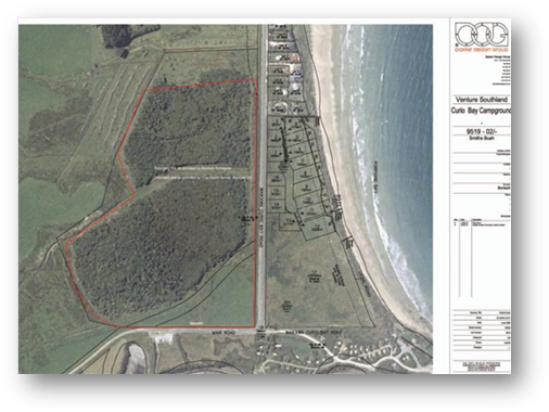
Figure 4: Red line defines the area known
as 'Smiths Bush'
4.1 Significance
of Smiths Bush
 The
significance of Smith’s bush in relation to the Petrified Forest had been
identified by Geologist Mike Pole (Appendix D) and Brian Rance (Technical
Support Officer – Biodiversity, Southland Conservancy, DOC).
The
significance of Smith’s bush in relation to the Petrified Forest had been
identified by Geologist Mike Pole (Appendix D) and Brian Rance (Technical
Support Officer – Biodiversity, Southland Conservancy, DOC).


4.2 Benefits
of Purchasing Smiths Bush
· Protection of the
site long term.
· The open paddock
area at its southern end is recognised as a suitable location for a wastewater
treatment plant.
· It enables
possible expansion of yellow eyed penguins nesting habitat.
· Because of its location,
it acts as a buffer area for the sensitive wildlife and reserve areas from
other development occurring in the area.
· It adds another
product to the whole ‘Curio Bay’ destination and appeal, once
walking tracks and associated interpretation is developed
· It celebrates the
site which is of utmost importance to the local community
· It enables the
prospect of realigning Mair Road in the future to improve road safety on the
access road.
4.3 The
Trust’s Approach
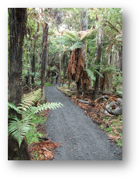
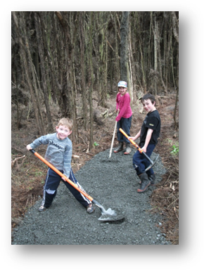
Once purchased, the first step was to erect predator proof
fences to allow undergrowth to be revitalised.
 The second
step was to work alongside DOC and the local community to develop a plan for
the proposed walkway through the bush – it would highlight and interpret
key sites and vegetation. It was also decided to split the development of
the track into two parts which would be developed separately to each
other. This was seen to make the project more manageable considering
volunteer labour and time as well as funding.
The second
step was to work alongside DOC and the local community to develop a plan for
the proposed walkway through the bush – it would highlight and interpret
key sites and vegetation. It was also decided to split the development of
the track into two parts which would be developed separately to each
other. This was seen to make the project more manageable considering
volunteer labour and time as well as funding.
 The
third step was to establish how to repay the Community Trust of Southland loan
as well as the development costs of the track.
The
third step was to establish how to repay the Community Trust of Southland loan
as well as the development costs of the track.
4.4 The
Curio Bay Living Forest and Walkway Project
 The Trust
launched the Curio Bay Living Forest and Walkway project in 2009.
People could support the project with a donation and in return they were
acknowledged by having their name engraved on one of the interpretation panels
to be situated along the walkway. The contributions would be used to erect
a stock proof fence, restore native species and develop the walkway.
The Trust
launched the Curio Bay Living Forest and Walkway project in 2009.
People could support the project with a donation and in return they were
acknowledged by having their name engraved on one of the interpretation panels
to be situated along the walkway. The contributions would be used to erect
a stock proof fence, restore native species and develop the walkway.
To date, the Trust have made excellent progress with
creating awareness of the initiative. This could not be achieved without
the significant support of the local community. The walkway is now gaining
national recognition with a recent visit by the Little Brown Kiwi (New Zealand
Adventure Education company), who completed a day’s Environmental Science
work in the area. They are currently working on making this an annual
feature in their adventure education programme.

4.5 Cost
of the Project
The total cost to undertake the project was estimated to
cost $279,405. This included $129,405 of estimated expenses related to
development of the walkway (track construction; plantings; interpretation
boards).
|
Task
|
Note
|
Estimated
Cost
|
|
Purchase
Price of Smiths Bush
|
$30,000 already secured Nature
Heritage Fund
|
$150,000
|
|
Development
of 1km Track
|
1km gravel track, wooden border,
gravel + weed cloth + four bridges – community to provide labour ($77
per metre as per DOC figures)
|
$77,000
|
|
Culverts
|
Access and internal culverts
|
$2,000
|
|
Stock
Proof Fencing
|
Of north and west boundaries,
labour to be donated
|
$5,000
|
|
Interpretation
Panels and Signage
|
Of significant sites along track.
9 panels @ $1,045
|
$10,405
|
|
Advertising
and Promotion
|
Of track, printing of brochures
etc
|
$5,000
|
|
Reforestation
of Bush
|
Internal and external planting
over 3 years
|
$30,000
|
|
|
TOTAL
|
$279,405
|
4.6 Funding
of the Project
 In 2007, the Department
of Conservation attempted to purchase the bush area alone, for protection
purposes. Unfortunately funding for the acquisition was not achieved by the
Department despite full support by local management and staff.
In 2007, the Department
of Conservation attempted to purchase the bush area alone, for protection
purposes. Unfortunately funding for the acquisition was not achieved by the
Department despite full support by local management and staff.
When the opportunity to purchase the bush block, together
with the open pasture to the south adjoining the Reserve arose in 2009, the
Trust decided that positive steps to ensure long term protection of this unique
area was the best option, and put a funding proposal to the Community Trust of
Southland (CTOS).
 CTOS agreed with the
Trust’s vision and objectives of the acquisition and supported the cause
by providing a bridging facility to ensure that the opportunity to acquire that
land could be taken up. This funding facility is in the form of an interest
free loan and is conditional on the Trust securing funding from other sources
to cover the acquisition cost as well as facilitating designation of the land
as a reserve under the Reserves Act 1977.
CTOS agreed with the
Trust’s vision and objectives of the acquisition and supported the cause
by providing a bridging facility to ensure that the opportunity to acquire that
land could be taken up. This funding facility is in the form of an interest
free loan and is conditional on the Trust securing funding from other sources
to cover the acquisition cost as well as facilitating designation of the land
as a reserve under the Reserves Act 1977.
An application to the recently closed Nature Heritage Fund
for support with the land purchase price ($150,000) has resulted in a grant of
$30,000 being allocated. The Trust have since repaid this amount to the
CTOS and are due to repay the outstanding amount by 2015.
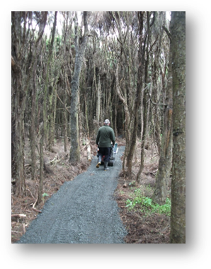
4.7 Progress
to Date
The goal is to have a debt free walkway and recreational
asset for the local community and visitors to enjoy. To date the Trust
have secured a total of $53,740 and this includes track sales and donations of
$8,000 and grants of $35,000. It is also important to note the in kind voluntary
labour contribution totalling $10,000.
The Trust have recently completed construction of the first
part of the track and interpretation panels along this section are currently
being developed.

Section 5: Waste Water Infrastructure
The Southland District Council alongside the local community
has long endeavoured to identify an appropriate and affordable waste water
solution and provision of toilets for Curio Bay.
This has presented challenges in terms of:
1. Identifying
a system which accommodates the sensitivity of the local environment and
significance for local iwi.
2. Funding
this system – there is no longer the level of central government support
and subsidies as there once was which then potentially leaves the burden on local
ratepayers (of which there are only 28)
A solution was identified five years ago and was estimated
to cost $1.3 million. The local community and SDC investigated this as
much as they could, even reaching the consent stage by attaining a discharge
permit. The insurmountable issue was funding it – the funding just
couldn’t be sourced.
Since this time, visitor numbers continue to increase (even
without promotion) and the infrastructure continues to struggle and fail with
more regularity. There are real concerns regarding the health and safety
of the local community and visitors, let alone the extreme threat to this
unique environment.
5.1 Other
Options Investigated
Options to ‘cart and carry’ the waste out of the
area, (particularly in peak visitor times) have been investigated. Even though
this option would cost less to develop (upgrade of septic tank system), the
ongoing costs of trucking the waste out of this remote location considering the
volumes experienced in the peak season and projected increases in visitors make
it financially unviable. It was assessed that this did not provide a long
term solution for the area.
DOC have also looked at ‘dry self contained
toilet’ solutions for Curio Bay. However, the numbers of visitors and
future needs and potential growth of the area mean that toilets connected to a
waste water reticulated system provide a lot more certainty and protection for
the local environment.
Neither option allowed for the future growth of the area,
sensitivity of the local environment and proposed developments planned in the
area.
5.2 A
Solution is Identified
In 2012, SDC engineers identified a solution suitable and
affordable for Curio Bay. Since the initial system had been identified 6
years previously, there had been developments in technology and this particular
system has been installed at another similar location in Papatowai a short
distance away.
This solution looks to be compatible with the local
environment and needs of the community and iwi which is extremely important.
Because it is a reticulated modular system, it provides opportunities for
future connections from privately owned properties. A key difference to
the previous proposed solution is discharging the treated waste water to water
onsite. Consultation with local iwi, the community and Environment
Southland is underway to further investigate this proposal.
The other significant difference is its price. Estimated to
cost $500,000 - $600,000, this is under half the initially proposed
system.
5.3 Funding
the Solution
Council has allocated $323,000 to date towards the provision
of infrastructure at Curio Bay. It is agreed that the priority is to
address the waste water and toilet situation and therefore, all of this funding
will be allocated to this.
 DOC acknowledge the
responsibility they have as caretakers of the Petrified Forest platform to look
after the needs of the 100,000 visitors. They also accept that the
current situation and lack of toilets and car parking is not ideal.
However, their challenge is that they are unable to contribute financially
towards assets which they do not own such as a waste water system.
There has been ongoing and significant consultation with DOC in recent years,
however, there do not appear to be ways around this fact.
DOC acknowledge the
responsibility they have as caretakers of the Petrified Forest platform to look
after the needs of the 100,000 visitors. They also accept that the
current situation and lack of toilets and car parking is not ideal.
However, their challenge is that they are unable to contribute financially
towards assets which they do not own such as a waste water system.
There has been ongoing and significant consultation with DOC in recent years,
however, there do not appear to be ways around this fact.
DOC has recently secured in principle, capital funding of
approximately $500,000 towards the provision of car parking, tracking and
toilets in the area. The initial plan was to build ‘dry self
contained toilets’, however with the recently identified new waste water
solution, DOC see the benefits of installing flush toilets which are connected
to the system. Again, the challenge is how they can contribute
considering their own rules and policies. This funding will also be
allocated to a car park, associated roading, tracking and interpretation much
of which is detailed in Section 10.
The current situation remains that considering the SDC
financial contribution, there is still a significant shortfall of $200,000 -
$300,000.
5.4 Progress
Continues
While work continues to secure the shortfall to fund the
system, investigation into the system continues.
· SDC have
contracted Opus to prepare applications for a permit to discharge which will be
lodged in September 2013. Depending on the outcome of this, the next step
would be to tender the project and an exact cost would then be known.
· Consultation with
the local community and iwi is also important and underway
· Investigation into
understanding how the proposed system fits with the rest of the area
· SDC continue to
observe the system installed at Papatowai.
· Consideration
of ongoing costs of the system and partnership arrangements to fund.
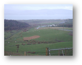
Figure 12: Smiths Bush corner where waste
water is proposed to be located
Section 6: Curio Bay Recreation Reserve
The previous sections covered the Curio Bay waste water and
walkway projects. The third project consists of a number of initiatives
associated with the Curio Bay Recreation Reserve, in particular three key
elements:
1. Development
of a natural heritage visitor centre to be situated at the
“Central Arrival Area” (including education and interpretation
displays and public toilets)
2. Redevelopment
of the Curio Bay camping ground (including new amenity block containing
toilets for campers and more powered camp sites)
3. Development
of the site infrastructure at Curio Bay (i.e. the new “Central
Arrival Area” and associated roading, landscaping, walkways, parking).
6.1 Total
Cost of the Project
The total cost to undertake all components
of the upgrade of the Curio Bay Recreation Reserve is estimated to cost just
under $4 million. It can be split into three separate components
(heritage centre, site infrastructure and camp ground), however all components
overlap and as such need to be considered alongside each other. For example,
the heritage centre can not be developed without providing suitable access
roading and car parking facilities.
|
Total Project Cost
|
|
Estimated
Cost $
|
|
Natural
Heritage Centre
|
|
1,826,000
|
|
Camp
Ground Redevelopment
|
|
1,385,000
|
|
Infrastructure
Site Development (car park, roads, landscaping, tracking)
|
|
693,000
|
|
|
TOTAL
|
$3,904,000
|
Further details regarding each of these
three components are provided below as well as in Sections 7, 8, 9 and 10.
6.2 Funding
for Implementation
An important point to note is that while it
is essential that the project be viewed in terms of what the long term vision
is, in terms of implementation, the reality is that individual components are
most probably going to be funded independently from a variety of sources. For
example, funding which DOC can access is eligible to fund the car park and
infrastructure associated with meeting the needs of visitors to the Petrified
Forest but will now be located at the “Central Arrival Area”.
To date approximately $2.2 million has been
secured towards projects associated with the Curio Bay Recreation Reserve. For
example, 7.5 shows confirmed sources of funding for the heritage centre.
|
Natural Heritage Centre
|
|
Expense
|
Estimated
Cost $
|
Heritage Centre
|
|
Building
|
850,000
|
See
Appendix F
|
|
Site Works 460m2
|
200,000
|
Machinery,
cartage and supply of materials, testing, imported fill
|
|
Water Supply
|
20,000
|
Assume
connection to spring source nearby
|
|
Heritage Interpretation
|
100,000
|
Panels,
displays, audio visual system for theatre
|
|
Internal fit out
|
100,000
|
Main
desk, souvenir area, soft furnishings, decorating, heating/cooling, solar
panels
|
|
Landscaping
|
140,000
|
Decking,
outdoor seating area, plantings, relocating of cabbage trees
|
|
Professional fees
and consultation
|
250,000
|
Resource,
building consents, conceptual plans, consultation with stakeholders, project
management
|
|
Contingency 10%
|
166,000
|
|
|
|
1,826,000
|
|
|
Camp Ground Redevelopment
|
|
Expense
|
Estimated
Cost $
|
Notes
|
|
Ablution Block
Building
|
565,000
|
See
Appendix E; includes all fit out, connections.
|
|
Power
|
50,000
|
To
extra camping sites
|
|
Site Works and
preparation
|
100,000
|
Machinery,
cartage and supply of materials, testing, imported fill, upgrade to powered
sites
|
|
Tidy up
|
20,000
|
Tidy
up existing toilets at Porpoise Bay, recycling existing camp shop
|
|
Car Parking and
Roading
|
180,000
|
Porpoise
Bay car park tidy, new roads through out camp ground and at entrance
|
|
Landscaping
|
180,000
|
Relocating
flax, regrassing, headland reorganisation
|
|
Professional fees
and consultation
|
180,000
|
Resource,
building consents, conceptual plans, consultation with stakeholders, project
management
|
|
Contingency 10%
|
110,000
|
|
|
|
1,385,000
|
|
|
Infrastructure Site Development
|
|
Expense
|
Estimated
Cost $
|
Notes
|
|
Tracking
and Interpretation
|
50,000
|
Walking
tracks within reserve, interpretation panels, panels, signage
|
|
Tracking
and outdoor interpretation
|
100,000
|
Walking
tracks, panels, interpretation, signage
|
|
Car
Parking and Roads
|
400,000
|
Main
car park at central arrival area, site preparation
|
|
Porpoise
Bay
|
15,000
|
Improved
beach access
|
|
Professional
fees and consultation
|
60,000
|
Resource,
building consents, conceptual plans, consultation with stakeholders, project
management
|
|
Contingency
10%
|
68,000
|
|
|
|
693,000
|
|
6.3 Collaborative
Approach means sharing of infrastructure and associated costs
It is also important to note that since the
MOU has been signed, the collaborative approach means that there is now an
ability for projects to overlap and share infrastructure in particular, thus
saving costs. It has also meant that the best long term solution can be
identified because all parties are working together.
An example of this is the provision of
toilets. The main block of public toilets to meet the needs of the
majority of all visitors to the area will be provided at the “Central
Arrival Area” and attached to the Natural Heritage Centre facility.
They will be connected to the proposed waste water system and this provides
long term sustainability issues and cost savings. Previous plans had
shown options of creating ‘dry toilets’ and carting away waste.
6.4 Waste
Water Infrastructure
The underpinning piece of the puzzle is that the waste water
issues be solved. No other upgrades of the camp ground or development of
a natural heritage centre can be attempted unless a solution is found. This has
caused delays in recent times. With the identified solution and proposed
installation as soon as is possible, this allows the implementation of other
components.
Section 7: The Natural Heritage Centre
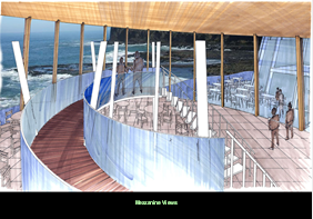
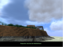
7.1 Background
 In
2003, the first guiding document for the area and the Trust was developed by
Blakely Wallace and Associates. Entitled ‘Curio Bay 2010 and
Beyond’, its key purpose was to investigate the feasibility of a tourism
enterprise at Curio Bay which would:
In
2003, the first guiding document for the area and the Trust was developed by
Blakely Wallace and Associates. Entitled ‘Curio Bay 2010 and
Beyond’, its key purpose was to investigate the feasibility of a tourism
enterprise at Curio Bay which would:
· maximise
visitor experience
· minimise
user conflict
· protect
and enhance the natural environment and wildlife
·
foster and manage enterprise opportunities on the site.
Both the Trust’s and the community’s vision for this
project is…
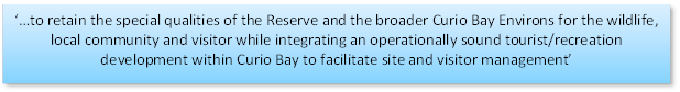
The concept has since been mandated by the wider South
Catlins community, and endorsed by the Southland District Council, Department
of Conservation and the Yellow Eyed Penguin Trust, amongst others.
Ongoing consultation with these stakeholders and others such
as local iwi remains a priority for the Trust.
7.2 Description
In recent years, the Trust has further investigated this
concept of a Natural Heritage Centre to be located alongside the existing
camping ground on the Curio Bay Recreation Reserve. It is intended to
form the hub for visitor management at the “Central Arrival
Area”. It is proposed that it will act as an interpretation,
education, information and visitor dispersal point to various activities and
areas within the Reserve. It will facilitate management of tourists in
particular with respect to the Petrified Forest, camp ground and yellow eyed
penguins.
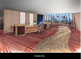
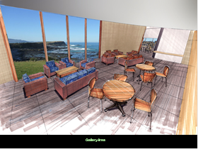 The facility will have a commercial focus to enable its
long term viability which in turn will sustain the public good elements of the
project. Plans to date have included it consisting of a café,
including internet access, camping shop store as well as an opportunity for
locals to showcase and sell their own crafts. Some conceptual drawings are
listed below.
The facility will have a commercial focus to enable its
long term viability which in turn will sustain the public good elements of the
project. Plans to date have included it consisting of a café,
including internet access, camping shop store as well as an opportunity for
locals to showcase and sell their own crafts. Some conceptual drawings are
listed below.
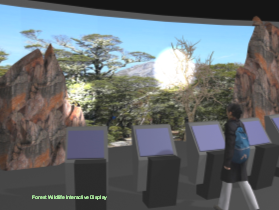
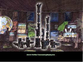
7.3 Economic
Benefits
The economic benefits of the project were seen as critical
in order to stimulate local economic development both directly and
indirectly. With this in mind, the Trust developed a business case and in
2008 was successful in being granted funding from the Ministry of Social
Development’s Enterprising Communities fund.

 A total
grant of $169,000 over a three period has enabled the trust to employ their
Project Coordinator as well as further investigate the heritage centre concept
and camping ground redevelopment.
A total
grant of $169,000 over a three period has enabled the trust to employ their
Project Coordinator as well as further investigate the heritage centre concept
and camping ground redevelopment.
To date, there have been two new businesses establish as
well as ongoing education and support of local businesses and the local
community.
The Curio Bay Natural Heritage Centre is
part of a regional approach to developing significant products to boost the
visitor experience in Southland. Most of these projects are public
private sector partnerships which is encouraged and the Southland Tourism
Strategy lists the importance of attracting investment through sound business
case investigation.
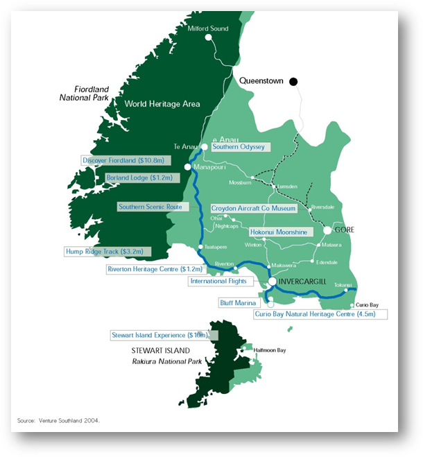 The Southland Tourism Strategy
notes that there are established iconic products such as Milford Sound and Hump
Ridge Track, however the emphasis is now to develop new complimentary products
such as Curio Bay in emerging areas such as The Catlins.
The Southland Tourism Strategy
notes that there are established iconic products such as Milford Sound and Hump
Ridge Track, however the emphasis is now to develop new complimentary products
such as Curio Bay in emerging areas such as The Catlins.

7.4 Progress
There have been two events since 2008 which the Trust have
been unable to control and which have caused them to re-evaluate the proposed
business plan which under pins the ongoing operational feasibility of the
facility. The first event being the challenging economic climate and subsequent
impact on availability of community grants and investment opportunities. The
second event was that a developer on an adjoining section, obtained permission
to operate a commercial bar/restaurant. This encroached on the
Trust’s potential business income streams.
As a result, the Trust staged the implementation of the
project and focused on ensuring that the foundations of the
project were in place, ready for the eventual development of the facility. This
included solving the issue of the waste water situation as well as undertaking
interpretation planning regarding the stories the centre would tell. The
Trust is currently looking at the exhibit’s design and how these stories
will be told.
In 2012, with the waste water situation
looking to be moving towards being solved, the Trust identified a final concept
for the Natural Heritage Centre building. Looking to cost $1.8 million
this as a significantly lower cost than some previous plan’s
estimates. The reason for this was that the facility was more basic in
nature providing the key priorities and basics while still fitting in to its
natural setting. Appendix F shows the suggested ‘look’ of the
building.
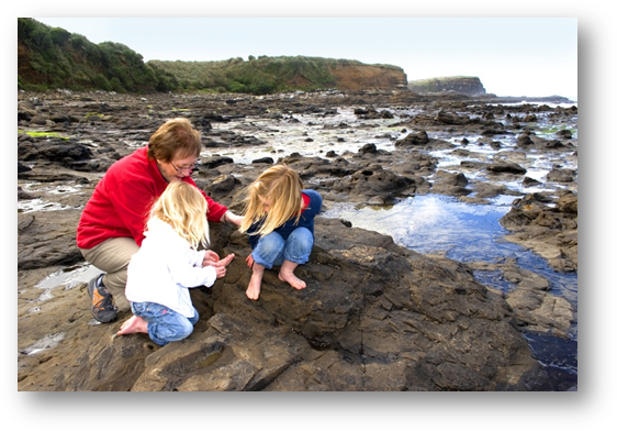
7.5 Cost
of the Project
The total cost to develop the heritage
centre has varied in recent years alongside various planning and consultancy
(Blakeley Wallace & Associates; 3 Bald Men consultants). However it
is estimated that a centre could be developed for approximately $3.9 million
(including the camp ground redevelopment and associated site infrastructure
– see Section 6). The building component on its owned will cost
$1.8 million.
|
Expense
|
Estimated
Cost $
|
Note
|
|
Building
|
850,000
|
See
Appendix F
|
|
Site Works 460m2
|
200,000
|
Machinery,
cartage and supply of materials, testing, imported fill
|
|
Water Supply
|
20,000
|
Assume
connection to spring source nearby
|
|
Heritage
Interpretation
|
100,000
|
Panels,
displays, audio visual system for theatre
|
|
Internal fit out
|
100,000
|
Main
desk, souvenir area, soft furnishings, decorating, heating/cooling, solar
panels
|
|
Landscaping
|
140,000
|
Decking,
outdoor seating area, plantings, relocating of cabbage trees
|
|
Professional fees
and consultation
|
250,000
|
Resource,
building consents, conceptual plans, consultation with stakeholders, project
management
|
|
Contingency 10%
|
166,000
|
|
|
|
1,826,000
|
|
As mentioned in 3.5, almost $2.3 million
has already been secured showing the commitment of various stakeholders and
community funders. Of this, almost $1.8 million has been allocated
specifically towards the development of the heritage centre and details are
shown below.
To
date the Trust has secured:
|
Funder
|
Amount (GST incl)
|
Note re Grant
|
|
Mataura Licensing
Trust
|
$300,000
|
Granted
2004 – 06 towards recreation reserve upgrade including heritage centre
|
|
Community
Employment Group
|
$47,000
|
Granted
2005 to assist with project planning
|
|
NZ Parks &
Conservation Fund
|
$21,000
|
Granted
2005 to assist with penguin management and conservation
|
|
Community Trust
of Southland
|
$800,000
|
Granted
in 2005 and re confirmed in 2012 (not yet uplifted).
|
|
Community Trust
of Southland
|
$600,000
|
Interest
free loan approved in principal in 2005
|
|
Total
|
$1,768,000
|
|
Section 8: The Curio Bay Camping Ground
The camping ground is situated on a recreation reserve which
is managed under the Reserves Act 1977 with control vested in the Southland
District Council. In 2006, Council passed over management of this Reserve to
the Trust by way of a long term lease. The Trust in turn has a service
and delivery contract with the manager of the facility who operates a company
called the “Curio Bay Holiday Park”.

 8.1 The Current Situation
It is agreed that the current amenities are basic and need
to be upgraded. In particular the kitchen, showers and some
toilets. The managers of the camp ground are also currently constrained
to operate out of a camp office which has limited facilities and space.
 There have
been quality issues associated with the current water source used by the camp
ground which are being addressed in the short term while the long term vision
of the area is worked towards. This is associated with the age of the
septic tanks.
There have
been quality issues associated with the current water source used by the camp
ground which are being addressed in the short term while the long term vision
of the area is worked towards. This is associated with the age of the
septic tanks.
There is currently no common room or area for people to
shelter in from the weather.
There are currently only 15 camping sites which are
connected to power. Plans indicate that this could easily be doubled with
careful planning which helps to increase the viability of the camp ground as a
business.
Presently there is no separation of day visitors to the
beach and people camping in the camp ground. This means that all
facilities are currently shared. All visitors also travel through the
camp group passing camp sites.
 Camping is not
currently preferred on the headland area, it is meant only be used as a
“back up” to manage over flow of visitors in very busy times.
This is because there are no toilets close to this area and it is a sensitive
area which is exposed to the weather. The Trust also wish to try and
create more picnic recreation areas by moving and replanting flax for day
visitors to utilise.
Camping is not
currently preferred on the headland area, it is meant only be used as a
“back up” to manage over flow of visitors in very busy times.
This is because there are no toilets close to this area and it is a sensitive
area which is exposed to the weather. The Trust also wish to try and
create more picnic recreation areas by moving and replanting flax for day
visitors to utilise.
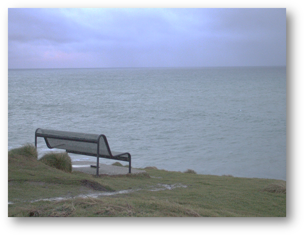

8.2 The
Proposed Upgrade
The objective is to allocate a specific area within the
reserve for camping, reorganise the layout of that area to allow it to work
efficiently, and upgrade facilities to meet or exceed user expectations - while
retaining the unique wilderness feel of the location. The Trust believes
that this can be achieved with careful planning and implementation.
Paddy Baxter Design Group have completed the overall design
and layout of the camping ground which includes a new Amenity/Ablution Block,
more powered camp sites, realigned access road, separation of day use from
campground and reorganisation of the headland. Development of cabins has
also been suggested, however this is not part of the current upgrade proposal.
At the proposed “Central Arrival Area” will be
the main parking and toilet facilities for the region as well as the natural
heritage centre. It is intended that all day to day running of the
camping ground also operate out of this facility.
The Curio Bay Holiday Park managers are working on their
requirements and business plan to support this process. It is the
intention of the Trust to work alongside the community and the camping ground
managers to move the upgrade forward. However, the upgrade cannot occur until a
solution for waste water has been found.
8.3 Cost
of the Upgrade
It is estimated that the upgrade will cost about $1.4m,
however, it is dependent upon other components associated with the Curio Bay
Recreation Reserve (e.g. Natural Heritage Centre and waste water).
Options to fund this upgrade will be considered alongside these other projects
that the Trust and SDC are involved with. However, it is essential that
there is a private partnership with a viable business to undertake the day to
day operation of the businesses.
|
Expense
|
Estimated
Cost $
|
Notes
|
|
Ablution Block
Building
|
565,000
|
See
Appendix E; includes all fit out, connections.
|
|
Power
|
50,000
|
To
extra camping sites
|
|
Site Works and
preparation
|
100,000
|
Machinery,
cartage and supply of materials, testing, imported fill, upgrade to powered
sites
|
|
Tidy up
|
20,000
|
Tidy
up existing toilets at Porpoise Bay, recycling existing camp shop
|
|
Car Parking and
Roading
|
180,000
|
Porpoise
Bay car park tidy, new roads through out camp ground and at entrance
|
|
Landscaping
|
180,000
|
Relocating
flax, regrassing, headland reorganisation
|
|
Professional fees
and consultation
|
180,000
|
Resource,
building consents, conceptual plans, consultation with stakeholders, project
management
|
|
Contingency 10%
|
110,000
|
|
|
|
1,385,000
|
|
8.4 Cultural
and Community Considerations
The Trust worked alongside Awarua Runanga to identify sites
of significance in the Curio Bay area. A report was developed and this
has been integral in considering the proposed layout of facilities and
infrastructure as well as the overall vision for the area.
The report also identified the desired process to undertake
various projects and to date there has been successful collaboration on a
number of initiatives in the area between all parties and local iwi.
The community have always been and will continue to be
considered in all planning. There has been a strong message from locals
that they wish to retain access to the Porpoise Bay beach and headland areas
and this has been incorporated into current plans.
Consultation and the collaborative approach forward will
continue.
8.5 Waste
Water Infrastructure
Again, reiterating point 6.4, the underpinning piece of the
puzzle is that a waste water solution be identified and implemented before any
plans for an upgrade of the camp ground can be finalised and the system can be
further investigated to be funded and implemented.
This has caused delays and frustration in recent times as
the Trust and local managers have continued to make do with the current
standard of facilities and amenities which desperately require upgrading.
This has been particularly difficult for the local managers, whose livelihood
is dependent upon this. While people absolutely love the location and
special feel of the area, there is general agreement that the facilities are
sorely lacking and require upgrading.
8.6 Progress
Forward
Once the plans for the waste water are confirmed, including
a timeframe for implementation, plans for the camp ground can be finalised and
then further investigated and costed.
At the same time, the current holiday park managers are
exploring business opportunities for them to partner with the Trust and SDC in
the project. Also, the Trust and SDC are currently exploring a new water source
which will meet the needs of users of the Reserve and various infrastructure
(waste water) as well as potentially the needs of the wider community.
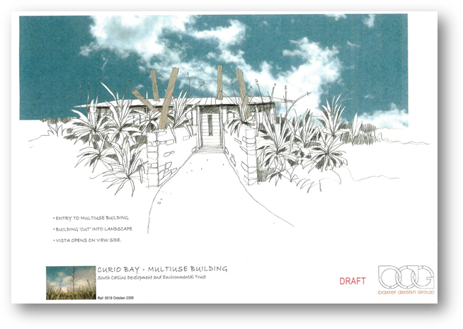
Figure 17: Conceptual drawing of possible ablution multi use
building
The Curio Bay camp ground overlooks Porpoise
Bay and is situated on the south headland. It also separates Porpoise Bay from
Curio Bay. Porpoise Bay sweeps gently from its north head, at the
entrance to the Waikawa Harbour around to its south head. A pod of
endangered Hector’s dolphins live here which can often be seen from the
beach.
The beach in particular has been a popular
location for local families and campers for many years (and more recently high
numbers of visitors) for recreation ie. Surfing, beach walking, swimming and
exploring rocks.
A section of the bay is part of a Maitaitai Reserve as per
the map in Appendix G, which reflects its significance for local iwi.
There are opportunities to enhance the area including the
access onto the beach, interpretation and recreational and infrastructural
facilities and amenities. All of these are interlinked with the proposed
upgrade of the camp ground.
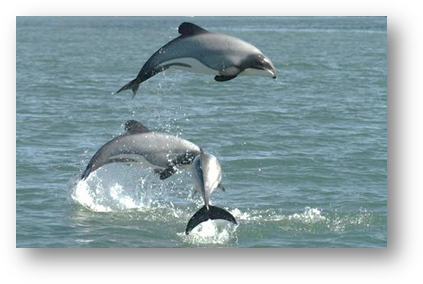
9.1 Beach Access
The main access to the beach in the southern end is from the
camp ground. This consists of a track through the flaxes which is fenced
off either side. It is agreed that this current access could be upgraded
to enhance access for all types of people to the beach, in particular, the
elderly, and this will be further investigated.
In recent times, this access route has been altered with the
addition of a gate at the bottom of it to try and deter sea lions from using it
to enter the camp ground. It was successful for a while but other
solutions could continue to be investigated.
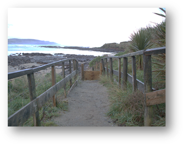
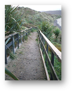
9.2 Sand
Dunes
There is concerning erosion of the sand dunes along the top
of the beach area. A number of factors have probably contributed to this
problem, namely activity and development on top of the sand dunes. It is also
accepted that over time, this type of erosion can be expected.
This is concerning because of the sensitivity of some of the
cultural sites which are becoming exposed as well as the safety concerns for
beach users.
The Trust and local community have recently begun
discussions with local iwi and other stakeholders to identify both short term
and long term solutions.
Figure 18: Eroding sand dunes
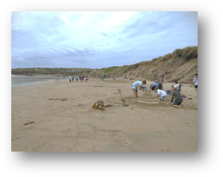
9.3 Interpretation
Opportunties
Currently there is
interpretation over looking Porpoise Bay near to the current camp shop (see
photo below). This provides information about the local wildlife and
environment. There are also areas with picnic tables and some shelter for
visitors to use (see photo below).
However, it is accepted
that there are opportunities to enhance interpretation and signage here as well
as recreation amenities for visitors. This would be in line with the
upgrade of the camp ground and potential new roading and tracking through out
the Reserve.
New interpretation and signage would also ensure it is
consistent with other interpretation through out the area which helps provide
flow within the Reserve for visitors. See 10.6 for more information about
possible interpretation.
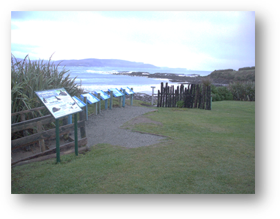
9.4 Beach
Safety
The current camp shop overlooks the Porpoise Bay beach and
as such has fulfilled an important role with beach safety. There are a
large number of swimmers in the water during the summer and there have been
occasions when a person in trouble in the water has been observed from the camp
shop and the alarm has been raised.
With the proposed new layout and development of the
“Central Arrival Area”, there will need to be thought around this
to ensure this important function for the community is continued.

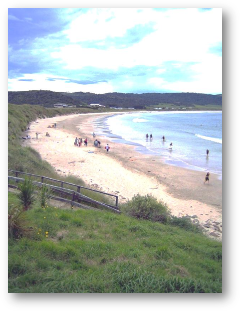
Section 10: Site Infrastructure Development
Section 3.4 and the map in Appendix C show the shared vision
as outlined in the MOU. This vision consists of developing a
“Central Arrival Area” which is where the majority of visitors to
the area would be directed to.
From this area, visitors would be directed to other parts of
Curio Bay including the Petrified Forest, Curio Bay Walkway, the camping
ground, Porpoise Bay beach and the Curio Bay headland. A network of
walking tracks would be developed to access these places (suitable for wheelchairs
and prams) but vehicle access would still remain for locals in particular.
The majority of infrastructure would be located near or in
the “Central Arrival Area” including car parking, toilets, visitor
information, camp ground office and the proposed heritage centre
facility. Directly opposite this area is where the proposed waste water
infrastructure is planned and a short walk allows access to the Petrified
Forest and Curio Bay Walkway.
There would need to be adjustments made to the current
roading layout, especially at the current “T” intersection to
ensure optimum safety and access to the Central Arrival Area.
10.1 Reasoning
behind the “Central Arrival Area”
· The shared vision
addresses the key issue of improving the management of visitors and vehicles
arriving in the area.
· By providing all
infrastructure in one place it allows it to be shared while ensuring the most
efficient and appropriate use of land.
· By encouraging
walking, this lowers the amount of vehicle movements in the area, particularly
with international visitors, but locals still retain the same access as
before.
· Concentrating the
infrastructure and amenities in one place also protects other more sensitive
cultural and environmental places in the area.
· It also provides
an opportunity for a business associated with running the camp ground and
heritage centre to be able to “capture” the majority of visitors to
the area which assists with long term viability of the whole enterprise.
|
Expense
|
Estimated
Cost $
|
Note
|
|
Tracking and
Interpretation
|
50,000
|
Walking
tracks within reserve, interpretation panels, panels, signage
|
|
Tracking and
outdoor interpretation
|
100,000
|
Walking
tracks, panels, interpretation, signage
|
|
Car Parking and
Roads
|
400,000
|
Main
car park at central arrival area, site preparation
|
|
Porpoise Bay
|
15,000
|
Improved
beach access
|
|
Professional fees
and consultation
|
60,000
|
Resource,
building consents, conceptual plans, consultation with stakeholders, project
management
|
|
Contingency 10%
|
68,000
|
|
|
|
693,000
|
|
10.2 Access
into the Area
It is agreed that the current layout of the T intersection
is confusing and could be improved for overall improved visitor management and
safety.
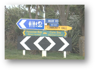 On arrival
into the area, currently, people have an option of turning left into the
camping ground/beach area or right towards the Petrified Forest.
On arrival
into the area, currently, people have an option of turning left into the
camping ground/beach area or right towards the Petrified Forest.
The proposed plan is to encourage visitors to drive forward
into the “Central Arrival Area” and car park. This will be
achieved by altering this current intersection and with signage. Local
people who wish to drive directly to the Porpoise Bay beach and headland areas
will still be able to do this. The improved layout is to target visitors,
particularly international visitors who will want to use toilets, visit the
heritage centre and petrified forest.
The new intersection will look to provide improved safety
for the growing number and types of vehicles in the area. It will also
consider the needs of local farmers and residents of Mair Road in particular.
10.3 The Car
Park
The proposed car park is modelled on infrastructure recently
developed at the Kepler Track, a destination with similar visitor numbers and
projected growth as Curio Bay. It is planned to be able to park up to 80
vehicles, including buses and camper vans and will have a sealed surface.
While this large sized car park may seem very large for the
area (especially since the current car park only accommodates 15 car parks), it
is essential to future proof as much as possible. The vision agreed by
all parties is to look at the future needs of the area and plan
accordingly. Indications are very probably that visitor numbers will
continue to rise considering other developments in the area (e.g. Natural
Heritage Centre). There may be an opportunity to stage the construction
of the car park however. This is all yet to be confirmed and plans are
currently still in conceptual stage.
The key challenge is to situate this infrastructure carefully
and appropriately so that it is accessible and easy for people to use, but does
not ‘overcome’ the local environment and people’s overall
experience of the area.
Current plans show that it looks possible to situate the car
park to the right of the access road to the “Central Arrival Area”
in an area currently bordering the yellow eyed penguin nesting habitat.
There will continue to be consultation with the Yellow Eye Penguin Trust, local
community and engineers to ensure it is situated in the most appropriate place.
It is also envisaged to use careful and appropriate
landscaping and re planting of cabbage trees and flaxes to ‘soften’
its appearance.
There are currently two plans being considered for the car
park which can be seen in Appendix H. Further investigation is required
to identify what will fit best with the local environment.
10.5
Enhancement of the current water supply
 The current water supply from the existing source does not meet the
new standards for water quality for supplying water to 25 or more people. The
Trust and SDC intends to upgrade the take point in conjunction with the rest of
camping ground upgrade. This is essential to ensure that quality and safe
drinking water is provided to meet compliance and standards as well as
people’s needs and expectations.
The current water supply from the existing source does not meet the
new standards for water quality for supplying water to 25 or more people. The
Trust and SDC intends to upgrade the take point in conjunction with the rest of
camping ground upgrade. This is essential to ensure that quality and safe
drinking water is provided to meet compliance and standards as well as
people’s needs and expectations.
10.4 Toilets
As noted previously, there are currently no toilets for the
100,000 visitors to the Petrified Forest (they have been required to walk to
the camping ground and many do not). A key function of the “Central
Arrival Area” is to provide the main block of toilets for all visitors to
the area which would be connected (or situated very close) to the Natural
Heritage Centre as well as the car park and arrival area.
Again, identifying a waste water solution is crucial in
developing these toilets. The solution identified would dictate the type
of toilet to be provided e.g. ‘flush’ toilets connected to a waste
water system or ‘dry’ toilets which would require emptying of
septic tanks.
Previous plans that DOC have undertaken initially assumed
that the waste water issue could not be overcome and plans were to install
‘dry’ toilets in the area. While ‘dry’ toilets
would have certainly been an improvement on the current situation, there would
have been ongoing costs to cart the waste away, which can be significantly
decreased by connecting to a reticulated waste water system. It is also
assumed that visitors prefer flush toilets vs dry toilets. The most
important point is that providing flush toilets connecting to a scheme,
provides the best long term management and protection of the area and best meet
current and projected needs.
It is also important to reiterate that the proposed amenity
block within the camp ground would provide toilets and showers for campers
only. Existing toilets at Porpoise Bay would be tidied and retained for
use by day and beach visitors.
10.6 Interpretation
and Tracking
The benefit of creating the ‘central arrival
area” is that visitors (in particular international visitors) are
encouraged to park in this area and then walk the short distances to various
sites e.g. petrified forest. This provides better management in terms of
controlling vehicles and dispersal of visitors. It also means that campers and
day visitors can be separated.
The key will be to ensure that visitors are firstly directed
into the central arrival area and then are informed about various sites at
Curio Bay and how to visit them etc. There will then need to be
sufficient tracking and pathways linking sites to the central arrival
area. These would need to be suitable for the significant quantities of
people using them (e.g. 100,000 currently walking to the petrified forest) as
well as accessible and appropriate for as many people as possible (e.g. push
chairs, wheel chairs).
Tracks would also need to take into consideration
camper’s needs and privacy, local iwi sites as well as wildlife, in
particular the yellow eyed penguins. This will be achieved with ongoing
consultation.
Along the tracks, interpretation could be developed to
explain and interpret what people are viewing. It would also give them an
insight into the area and the history and stories associated with it. It
is envisaged that all interpretation will have a consistent look about it at
all sites at Curio Bay e.g. walkway, petrified forest, Porpoise Bay. This
can be achieved with collaboration of all stakeholders and agreement of an
overall interpretation plan.
Figure 20: Conceptual drawing of possible
interpretation through out the Curio Bay area
There is no disputing the uniqueness and sensitivity of the
area. Visitors are coming, and will continue to be attracted to the area
and the community recognise the opportunities in terms of stimulating their
local economy and creating employment opportunities.
There is a real desire from key stakeholders to work
together towards addressing the significant inadequate infrastructure before it
has further negative health and safety and environmental impacts.
Significant steps forward in recent times reflect this (signing of the MOU).
The provision of toilets and the waste water system underpin
all future opportunities and the overall protection of the area. Now that there
is an affordable solution identified and confirmed financial commitment from
Council, there is a real desire to move this to forward. This will
require confirming all funding and working alongside local iwi and Environment
Southland to further investigate the system.
However, plans for other components such the natural
heritage centre, camp ground upgrade, curio bay walkway and new car park can
also be moved forward alongside progress on the waste water.
Appendix A: Information about the Trust
The Trust
The South Catlins
Development and Environmental Charitable Trust (the Trust) was
formed in 2002. Prior to this they had been working as a steering
committee called the South Catlins Community Enterprise Committee. The
Trust covers the South Catlins area, which is geographically identified as
extending between and including Waikawa, Curio Bay, Otara, Tokanui, Waimahaka
and Fortrose.
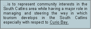
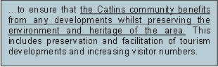 The Role of this Trust… The
Trust’s Overall Objective is…
The Role of this Trust… The
Trust’s Overall Objective is…
The Trust:
· Consists of experienced
volunteer trustees who represent a community with a passion and who are
committed to achieving the vision and objectives of the Trust.
· It is a registered
charitable trust with the Companies Office and a charity with the Charities
Commission.
· Has worked hard to
develop partnerships with a number of local community groups, funders and local
government organisations over a number of years including local iwi.
· By way of a long term
lease with the Southland District Council (SDC), manages the Curio Bay
Recreation Reserve which has the Curio Bay Camping Ground onsite.
· Employs a part time
‘Project Coordinator’ with the assistance of the Ministry of Social
Development’s Enterprising Communities Fund ($169,000).
· Is undertaking three key
projects related to development of a heritage centre, redevelopment of the
camping ground and acquisition and redevelopment of Smith’s Bush block.
· Has negotiated relevant
concessions with the Department of Conservation (DOC) to undertake guided walks
on the Petrified Forest.
· Works alongside Venture
Southland and Southland District Council staff.
Current Trustees:
· Pam
Callahan - Chairperson
· Nigel
Stirling - Treasurer
· Greta
Buckingham - Secretary
· Paul
Duffy
· Judy
Leith - Iwi representative
· Peter
Crosbie
· Jim
Burns
· Thomas
Buckingham
· Dani
Stratford
· Bruce
Lamb
· Milton
Smith
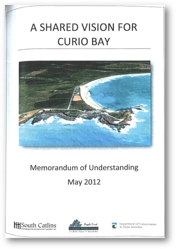 Appendix B: Memorandum of Understanding
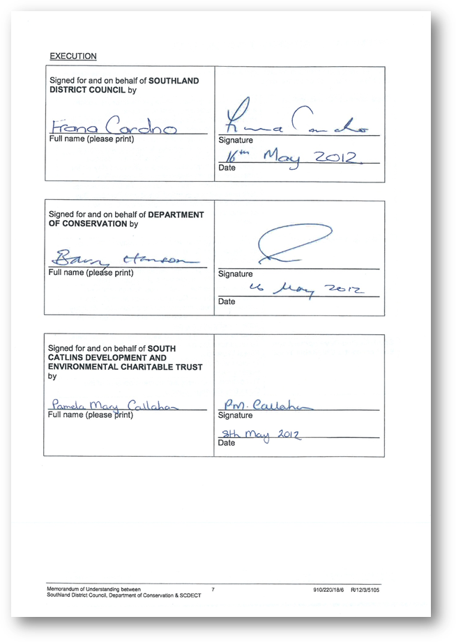
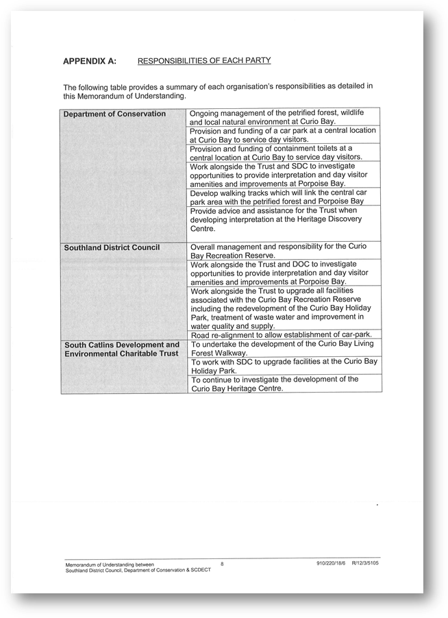
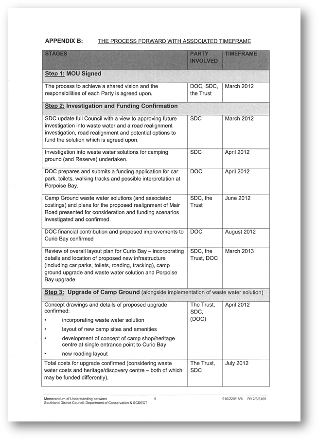
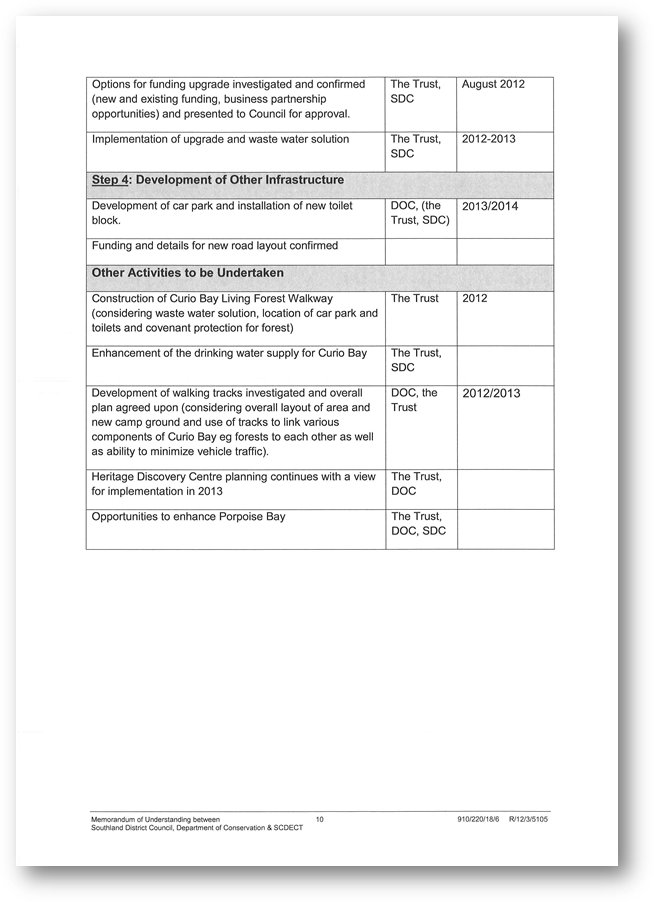
Appendix C: The Vision for Curio Bay
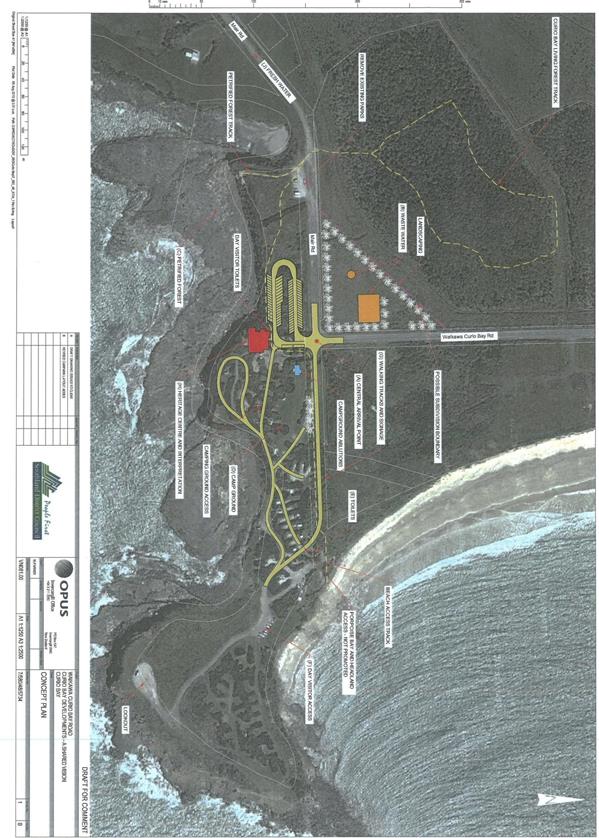
Appendix D: Mike Pole Supporting
Information
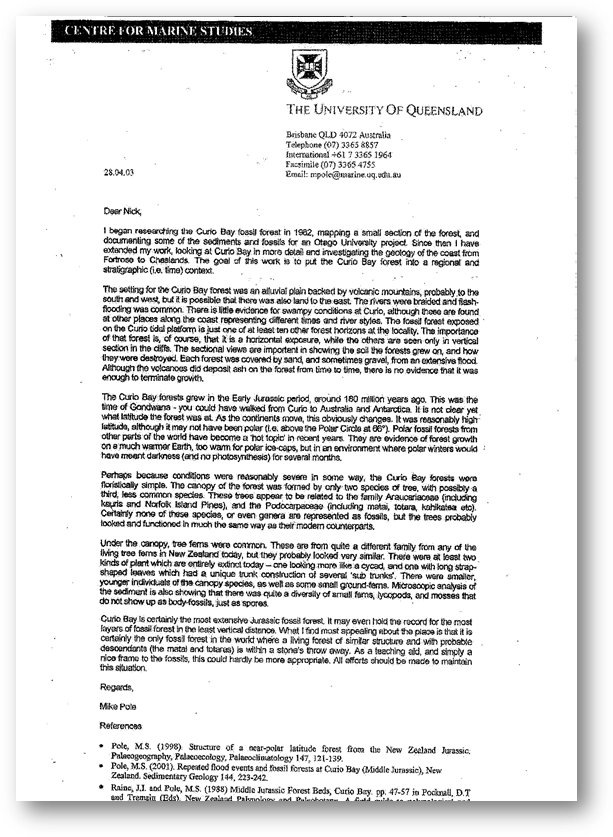
Appendix E: Building Plan for Ablution
Block
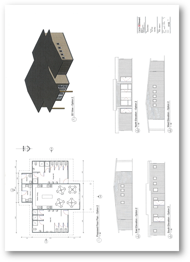
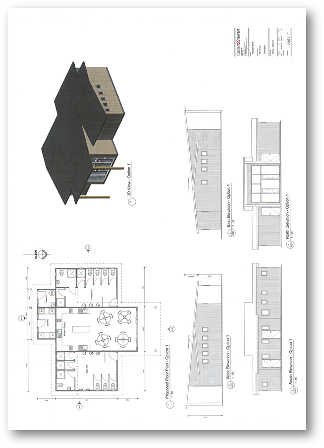
Appendix F: Building Plan for Natural
Heritage Centre
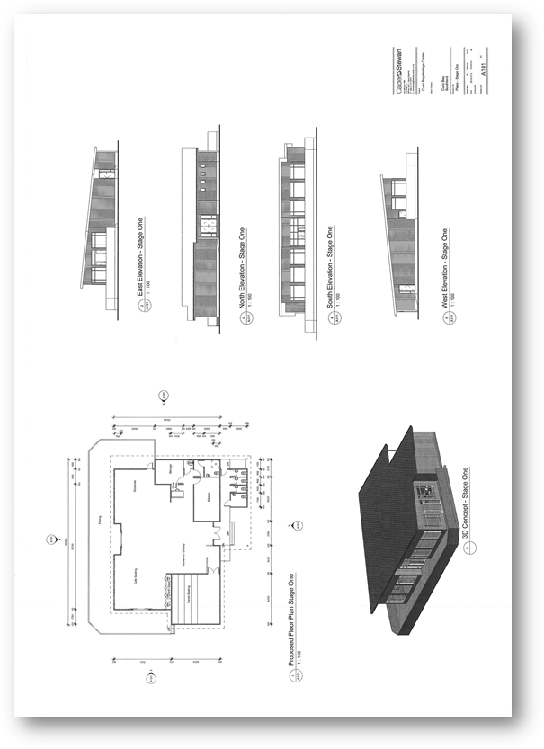
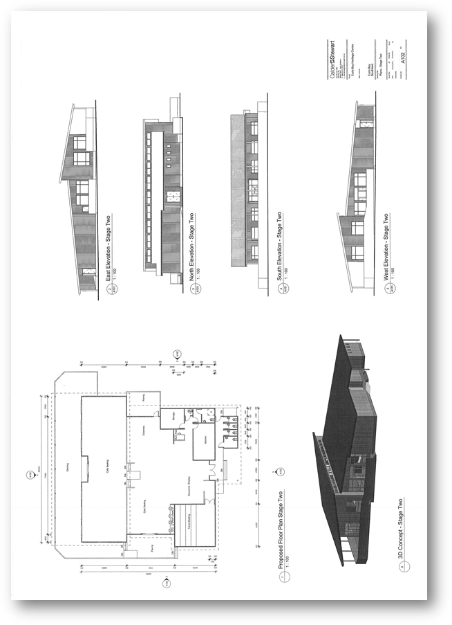
Appendix G: Waikawa Harbour Maitaitai
Reserve
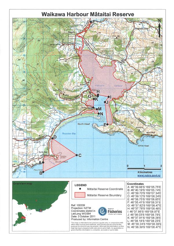
Appendix H: Possible Plans for the Car Park